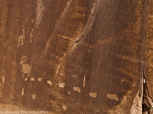
Mar 14 2011

Dry Fork – McConkie Ranch | Set 2

Saturday, March 12, 2011


Dry Fork | McConkie Ranch

Here are some more photos from our trip to the McConkie Ranch in Dry Fork on Saturday. Be sure to check out my first set of photos, too.


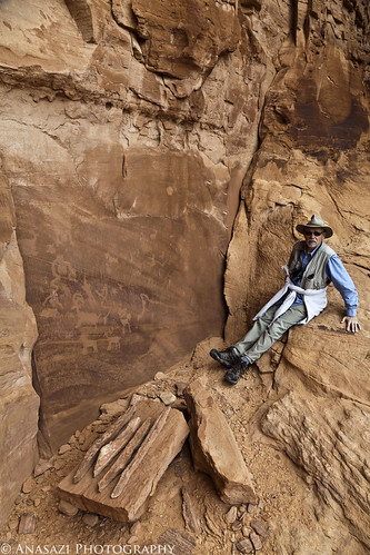
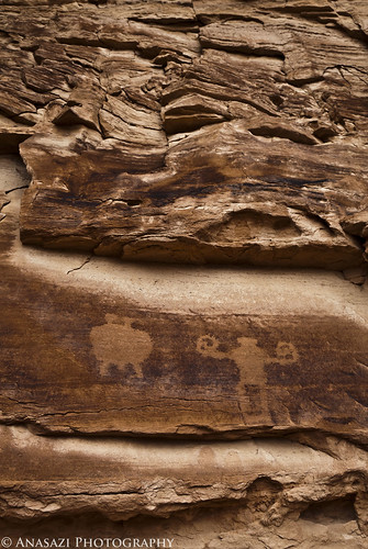
Above & Below
Above & Below

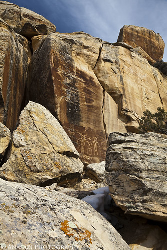
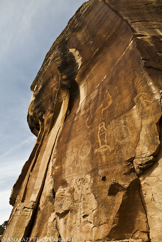
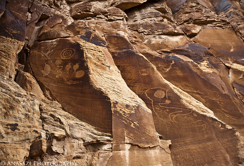
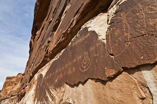
A close up of some shield-like petroglyphs along the Three Kings Trail. If you look on the sandstone below, you can find many more petroglyphs pecked into the darker stone.


Couple Through the Boulders

A couple of petroglyphs I’ve called ‘The Couple’ coming into view through the boulders.


In Between
In Between

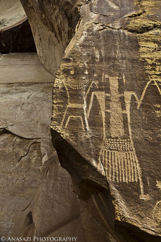
This anthropomorph along the Three Kings Trail is pecked into a dark colored sandstone which seems to be squeezed between a lighter sandstone and lichen covered stone.


Trophy Head
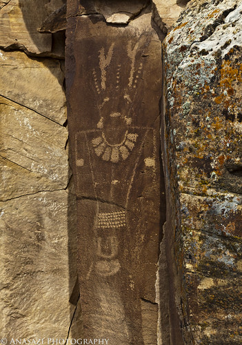
Trophy Head

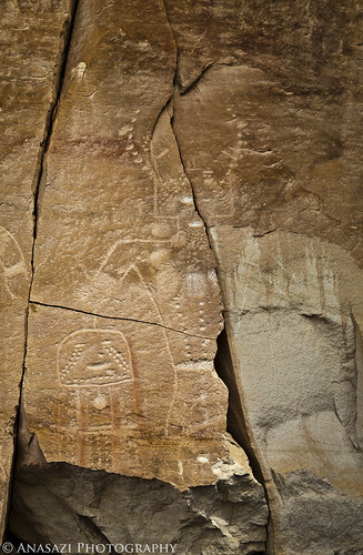
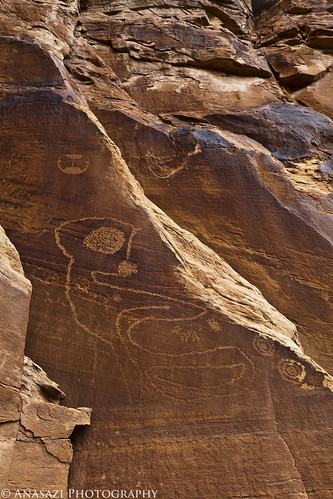
A very stylized and lifesized petroglyph of an anthropomorph holding a trophy head with weeping eyes along the Main Trail.


Big-Foot
Big-Foot

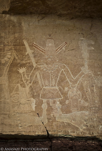
Certainly one of the larger and most unique pictoglyphs along the Main Trail The very large feet really stick out the most, but so do the red and white horns sticking out from his head. Not to mention the trophy head to his right. Very interesting figure.


High Petroglyphs
High Petroglyphs

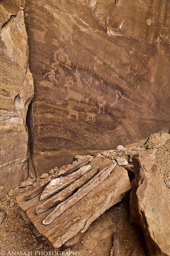
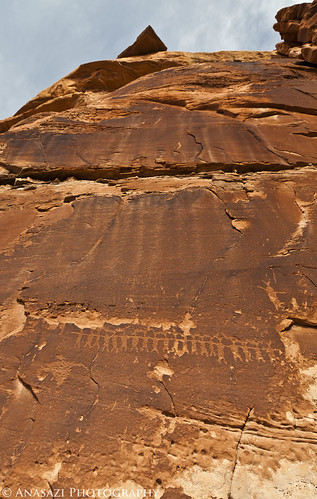
An interesting petroglyph panel located high in a cliff above the Three Kings Trail.


Broken Head Hunter
Broken Head Hunter

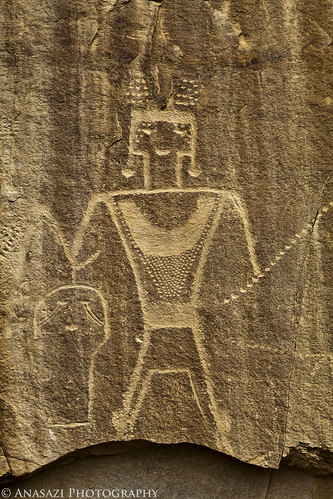
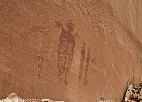
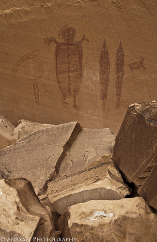
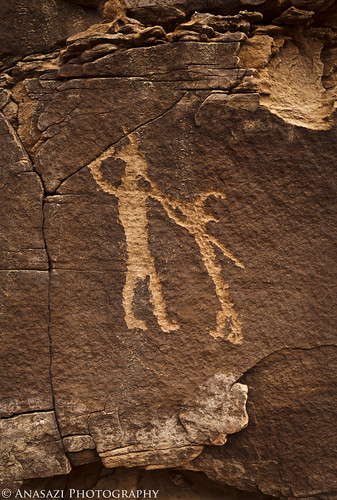
One of the many life-sized anthropomorphs along the Main Trail holding what appears to be a trophy head with weeping eyes. Based on the cracks through this panel, it may be lost when the stone finally gives way. The head could be lost a second time…


Elaborate
Elaborate

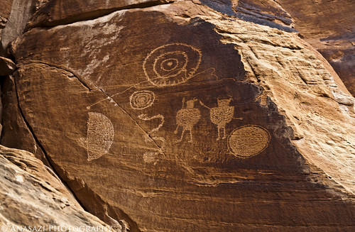
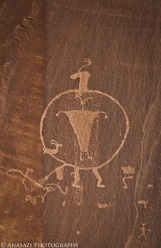
Two elaborately decorated petroglyphs along the Main Trail.


Still plenty more photos to go, so stay tuned for more!
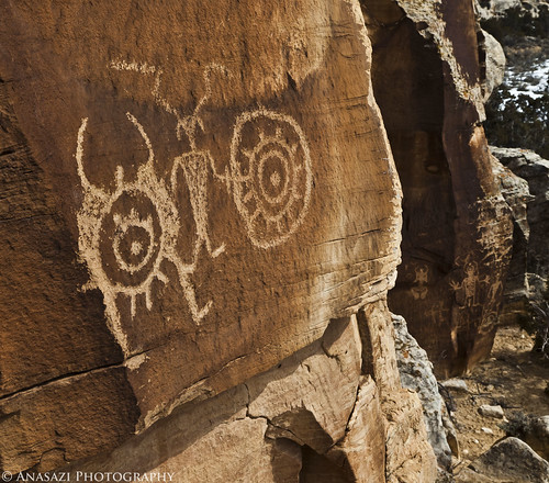

Mar 13 2011

Dry Fork – McConkie Ranch | Set 1

Saturday, March 12, 2011


Dry Fork | McConkie Ranch

Finally! I have wanted to get up to Dry Fork and check out the petroglyphs and pictographs on the McConkie Ranch for a while, so on Saturday Amanda and I headed up there for the day. These rock art panels are located on private property north of Vernal, but the McConkie Ranch has created two trails to view the rock art and allows the public to access them. I’d like to thank the McConkie Ranch for allowing the public to access the rock art located on their property!

Here’s a few photos I took in no particular order. Enjoy!


Circles & Shields
Circles & Shields

Looking up at a couple of the many petroglyph panels along the Three Kings Trail. Most of the morning was completely overcast, but luckily as we were headed back to the trailhead the clouds started to clear and blue skies were visible.


Red Spiral
Red Spiral

A simple red spiral pictoglyph (petroglyph & pictograph) along the Main Trail.


Y-Man
Y-Man

One of the many large anthropomorphic figures alone the Three Kings Trail. I named this photo after the figure to the right that looks like the letter Y.


The Clock
The Clock

This petroglyph & pictograph kind of reminds me of a clock. Actually, the long hand pointing towards the three o’clock position looks like an atlatl hitting the bullseye.


The Twins
The Twins

The Twins are the last set of petroglyphs along the Main Trail.


Three Kings
Three Kings

The famous Three Kings Panel, also known as the Sun Carrier is pretty amazing. Unfortunately, it’s located pretty high and the trail does not get too close to it. Luckily I had my 100-400mm lens with me!


I’ve got plenty more photos to go through, and will be posting them as I have the time, so stay tuned for more!

Mar 10 2011

Moab Area Rock Art VII

Sunday, March 6, 2011

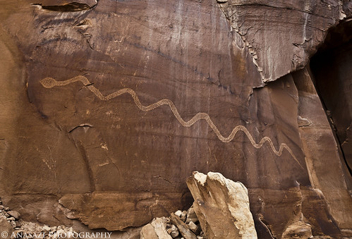
Solstice Snake

On Sunday I met my friend Marty who was going to take me to the Solstice Snake petroglyph. I have been searching for this particular petroglyph for a while and was hoping to find it before this year’s solstice. Marty had visited this particular petroglyph about 14 years ago and wanted to return. He had a general idea of where it was located, but not an exact location. Luckily his general location was close enough for us to eventually find it, even after going the wrong way and having to scramble around on many scree slopes…..adding an extra 2-3 miles to our hike for a total of 9.75 miles round trip. Even with the extra hiking, it was a great adventure and we had fun searching the area.

I, as usual, took a number of photos of the large snake petroglyph, so here are a few of them 🙂

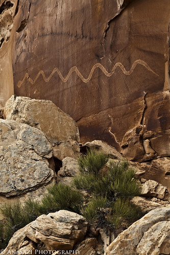
The Big Snake
The Big Snake

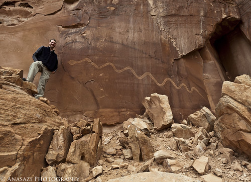
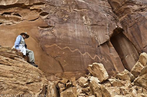
It’s a big petroglyph. I’ve been told it’s over 17 feet long. Here’s a photo with me (taken by Marty) for some scale.

The Serpent & I
The Serpent & I

…and now Marty with the snake.

Marty & the Snake
Marty & the Snake

A different view.

Solar Snake
Solar Snake

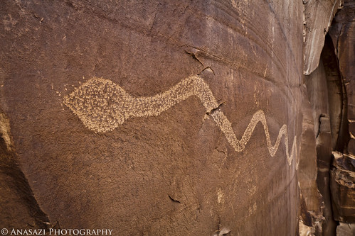
Face to face with the serpent.

The Serpent
The Serpent

After spending some time at the Big Snake, we continued our search for a pithouse and ‘Altar Table,’ as Marty referred to it, that was supposed to be nearby. We managed to find these after some searching, too.

We first came across the remains of a pithouse….and then I found these small petroglyphs on the cliff behind it.

Pithouse Petroglyphs

Next I found some more petroglyphs as we searched for the ‘altar’

Pithouse Panels
Pithouse Panels

Closer views of each panel…

Pithouse Second Panel

Circles Panel
Circles Panel

Finally we found the ‘Altar Table’ hidden in a small alcove nearby that we had to scramble up to. This is certainly one of the more unique scenes that I have come across while out exploring. Marty has a photos of this same setup that he took 14 years ago and was surprised to see that everything was still there. There were some petroglyphs here, too.

The Altar Table
The Altar Table

Marty at the Altar
Marty at the Altar

Another small petroglyph panel located above the ‘Altar Table’

Curly Arms
Curly Arms

The hike pretty much took us most of the day and we were pretty worn out by the time we reached our Jeeps again, but it was certainly worth it. I’m looking forward to heading back in June for the solstice!…..minus the heat….


Check out my other posts in the Moab Area Rock Art Series:

Moab Area Rock Art I | Colorado River Gorge / Golf Course / Kane Creek
Moab Area Rock Art II | Kane Creek Canyon & Potash Road
Moab Area Rock Art III | Mill Creek Canyon / Kane Creek / Bartlett Panel
Moab Area Rock Art IV | The Secret Grotto & More
Moab Area Rock Art V | Hidden Valley & Behind the Rocks
Moab Area Rock Art VI | Yellow Comet Alcove
Moab Area Rock Art VII | Solstice Snake
Moab Area Rock Art VIII | Dark Angel Petroglyphs
Moab Area Rock Art IX | Mill Creek Canyon


Mar 8 2011

Moab Area Rock Art VI

Saturday, March 5, 2011

Behold! The Comet
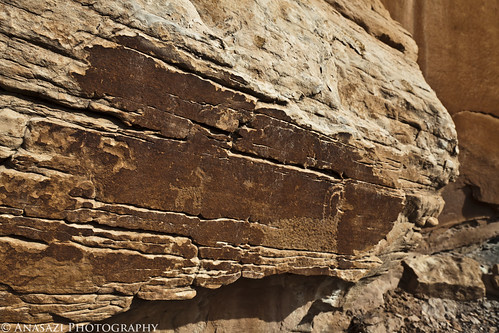
Yellow Comet Alcove

On Saturday, Jackson and I headed back to the Moab area to hike to the Yellow Comet pictographs. After researching a way to reach them, I found that there were two different routes down into the canyon. The closest route is supposed to be difficult to find if you don’t already know where it is, plus there is supposed to be a very tricky section that I didn’t like the sound of. Luckily, I managed to find another route down into the canyon, but the hike in the canyon would be about 6 miles longer. A few weeks back I stopped by the area to see if I could find the route down and did manage to find it. This time, I parked the Jeep as close as I could to the route down and we set off on our hike.

It was a short cross-county hike to the way down. The route down is a very old constructed cow trail. At some point in the past, an unknown person created this trail by drilling holes into the sandstone and pounding in steel bars. Rock, stones, branches and dirt were used to build a trail on top of these steel bars. There’s not much left of the trail, but it was still possible for us to get down even if it was a little tricky in places.

The Way Down

After scrambling down some large boulders and steep scree the rest of the way, we were soon in the wash at the bottom and the rest of the hike was much easier.

Canyon Hike

After a few more miles we reached the large alcove that houses the Yellow Comet pictographs.

Yellow Comet Alcove

Yellow Comet Panel
Yellow Comet Panel

Yellow Comet Above the Rocks

A photo of the panel with Jackson standing under it for scale…

Jackson & The Yellow Comet

Behold! The Comet
Behold! The Comet

Continue reading


Mar 1 2011

Moab Area Rock Art V

Sunday, February 27, 2011


Hidden Valley & Behind the Rocks

On Sunday the weather forecast called for 60% chance of snow in Moab. The same was true for Grand Junction and Moab on Saturday, so I figured they would be wrong again and I made my way over to Moab. It was a good decision because it turned out to be a perfect day for hiking……I’m glad I didn’t stay home… My destination for the day was to hike the Hidden Valley trail into the Behind the Rocks area to find some petroglyphs. This trail has been on my to-do list for a while, and now I regret not hiking it sooner. Besides being a nice hike, there were a bunch of petroglyphs to be found.


60% Chance of Snow
60% Chance of Snow

This is what a 60% chance of snow looks like in Hidden Valley…


Inside Out
Inside Out

One of the more interesting petroglyphs along the way…..a large shield-like figure with a smaller anthropomorph inside.


Line of Sheep Panel
Line of Sheep Panel

This panel contains the longest and straightest line of sheep I have come across so far.


Moab Fighting Men
Moab Fighting Men

These two figures look like they might be fighting.


Breaking Sheep
Breaking Sheep

As usual, there are plenty of bighorn sheep petroglyphs all around.


Cutouts Panel
Cutouts Panel

This line of small anthropomorphs reminds me of paper cutouts.


Sheep Tracks
Sheep Tracks

This bighorn has left some tracks behind.


Continue reading