Jun 12 2012

Cyclone Canyon & The Devil’s Pocket

Memorial Weekend in The Needles | Day 1
Saturday, May 26, 2012

Bright and early Saturday morning I was up and headed to The Needles District of Canyonlands National park to meet up with a few friends for the Memorial Day weekend. I made pretty good time and was soon on my way over Elephant Hill and at our campsite in Devils Kitchen. It took my just under four hours to reach the campsite from my house in Grand Junction. I quickly setup my tent and we were soon on our way to start hiking and exploring.

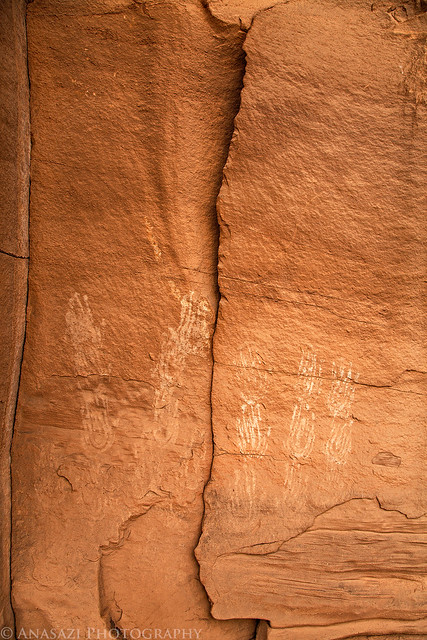
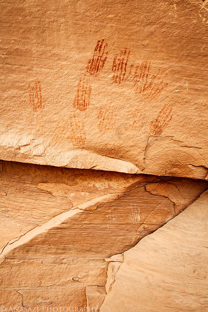
We started out by searching a new area of Devil’s Lane hoping to find something new. We did end up finding a few small panels of handprints which seem to be very common in The Needles.


White Hands by IntrepidXJ, on Flickr


Red Hands by IntrepidXJ, on Flickr

After taking a few photos of the handprints and searching the area a little more we started our hike from Devil’s Lane over to Cyclone Canyon. I should mention that it was VERY windy out! As we started the hike in Devil’s Lane we had to watch out for rolling tumbleweeds blowing through the graben. It was a sight to see tumbleweeds racing down the lane. The skies were also full of dust for much of the day, blocking the sunlight and blue sky.

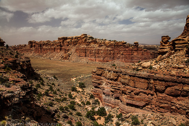
The view down into Cyclone Canyon as we started the descent.


Cyclone Canyon by IntrepidXJ, on Flickr


Jun 7 2012

Annular Solar Eclipse & The Paria Plateau

Friday – Sunday, May 18-20, 2012

A few months back I managed to get another pair of permits to the Coyote Buttes North area so that Amanda and I could visit The Wave again and explore a few new areas. It turns out that I had picked a great weekend to go without originally realizing it. Our permits were for Saturday May 19th and it just so happens that the Annular Solar Eclipse was going to be happening on Sunday the 20th and some of the best views of this event would be down in the same area. It couldn’t have worked out better! We would visit Coyote Buttes North on Saturday and then stick around for the Solar Eclipse on Sunday with a little extra time to check out Wire Pass.

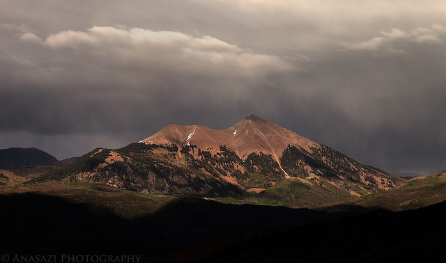
After work on Friday we finished loading up the Jeep and headed south through Utah to the Paria Plateau in northern Arizona. As we drove past Moab the light played hide and seek with the peaks of the La Sal Mountains in the distance.


In the Spotlight by IntrepidXJ, on Flickr

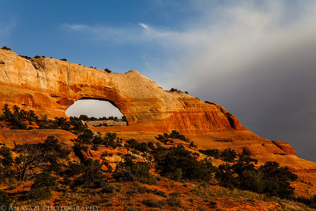
We also made a quick stop at Wilson Arch for a photo since the last photo I took here in late afternoon light was with a point & shoot camera.


Wilson Arch by IntrepidXJ, on Flickr

The sun was just setting as we drove through Bluff, and it lit up the clouds behind the Horse Boulder nicely.


Horse Boulder by IntrepidXJ, on Flickr


May 24 2012

The Needles & Indian Creek

Sunday, May 6, 2012

After a nice night sleeping along Indian Creek, I was awake again the break of dawn and having some breakfast. I packed up camp and then headed back into The Needles for another day of exploring. I was soon driving the rough road over Elephant Hill into the heart of the Needles. I ended up doing a little hiking and searching for some new rock art sites as I explored this beautiful area once again.

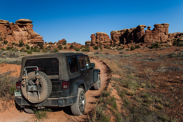
Driving through Elephant Canyon after crossing over Elephant Hill.


Elephant Canyon by IntrepidXJ, on Flickr

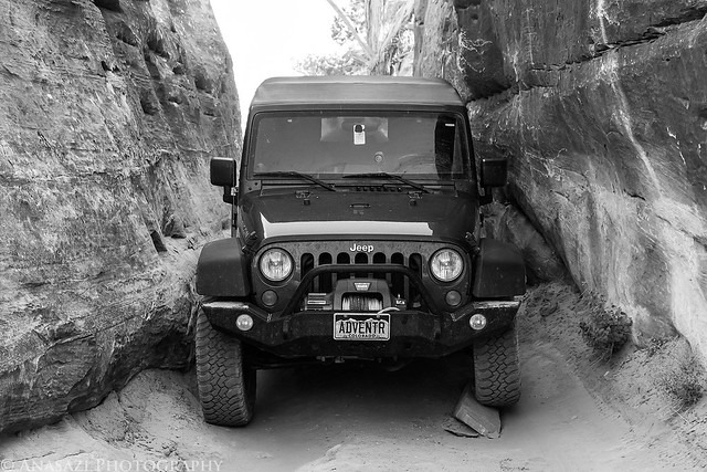
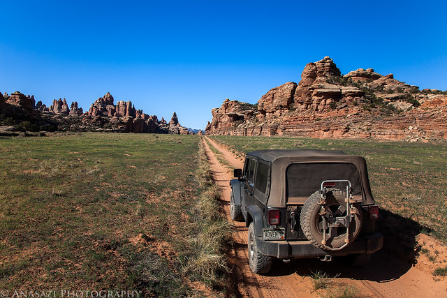
Squeezing my Jeep through this tight section into Devil’s Pocket.


Devil’s Pocket by IntrepidXJ, on Flickr

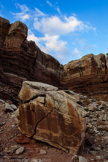
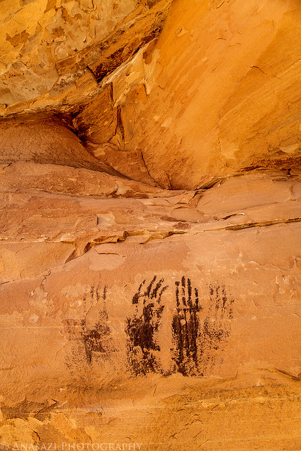
Interesting black handprints along the road.


Black Hands by IntrepidXJ, on Flickr

Great view in Devil’s Lane.


Devil’s Lane by IntrepidXJ, on Flickr


May 23 2012

Lost Canyon & Squaw Canyon Loop

Saturday, May 5, 2012

On Saturday morning I set out early to drive down to The Needles District of Canyonlands National Park. One of my goals for 2012 was to spend more time hiking and exploring in this amazing area. Unfortunately, because of circumstances earlier this year I was unable to make it down here until now, so I’m getting a later start than I had originally planned. Better late than never, I guess. I’ve still got plenty of time this year to return a few more times 😉

When I made it to the park I headed straight for the Squaw Flat Campground and started hiking the Lost Canyon and Squaw Canyon loop trail. It was a beautiful morning that was perfect for hiking. I made it to Lost Canyon in no time.

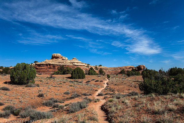
The well-used trail to Squaw Canyon, Lost Canyon and eventually Peekaboo.


Trail Ahead by IntrepidXJ, on Flickr

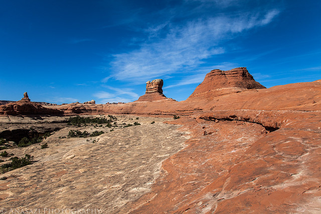
Crossing the sandstone of the Squaw – Lost Canyon Divide


Lost Canyon Divide by IntrepidXJ, on Flickr

Following the cairns.


Lost Canyon Trail by IntrepidXJ, on Flickr


May 16 2012

Backpacking Big Dominguez Canyon

Saturday & Sunday, April 28-29, 2012

I’m proud to say that I have finally gone on my very first backpacking trip. I’ve been collecting gear for the past few months and finally scheduled a trip with my friend Jackson and his dad. Since this was my first time, I wanted to keep the trip shorter and closer to home…kind of like a trial run to see how it all went. I’m happy to report that everything went well, and I’m looking forward to my next backpacking trip in the future.

Overall, I think I made some good choices when I was selecting gear over the past few months, but I’m sure I’ll be making some changes here and there to try and get the weight down further. With my pack loaded up with camping gear, food, water and camera gear, I was carrying just under 40lbs (with my camera around my neck, the weight on my back dropped to 35lbs). I’d like to get that number closer to 30lbs in the future, but it’s probably going to take some trial and error.

Since I was looking for a destination close to home and with not too long of a hike, we settled on Big Dominguez Canyon. It’s only about 20 miles from my house and was supposed to be about 7 miles in length. I have day-hiked the canyon from Bridgeport a few times before, but never gone more than a few miles in. This time we would be starting from the Cactus Park trailhead and descending down the canyon to Bridgeport.

After dropping off a truck at Bridgeport on Saturday morning, we loaded up my Jeep and drove up to Cactus Park. We were expecting to be able to drive to the rim of Dominguez Canyon and then hike down into the canyon, but that’s not quite how it worked out. What we found was a pretty new gate across the road about two miles from the canyon. Apparently, when this area became an official wilderness back in 2009, they must have extended the boundaries or removed the cherry-stem for this road and closed it. So, right from the start our planned hike was going to be two miles longer. We got our packs on our backs and started hiking down the closed road.

An old sign indicating the way to Dominguez Canyon found along the old closed road. The Wilderness Study Area sign is a bit outdated since this area is officially a Wilderness now.
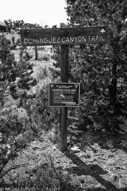

Dominguez Canyon Trail by IntrepidXJ, on Flickr

Jackson and his dad are birders, so they frequently stopped to find and identify birds they heard along the way.


Bird Watching by IntrepidXJ, on Flickr

When we finally reached the rim, we had a difficult time locating the trail down into the canyon. We ended up walking the rim looking for a way down the wrong way at first and then had to retrace our path and hike the other way. We did finally manage to find the steep route into the canyon, but it ended up adding a few more miles to our hike.

A great view from the rim of the canyon with Triangle Mesa and the Grand Mesa in the distance.
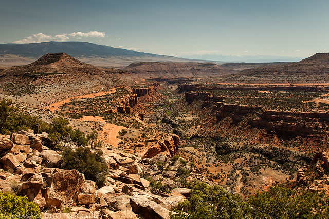

Big Dominguez Canyon & Triangle Mesa by IntrepidXJ, on Flickr

Jackson’s dad on the rim of the canyon as we tried to figure out the way down.
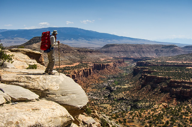

On the Edge by IntrepidXJ, on Flickr