May
10
2012
Saturday & Sunday, April 21-22, 2012
I was originally supposed to go camping this weekend with Amanda, but at the last minute she was unable to go with me, so I had to figure out something else to do. I sent an email to Marty to see if he was free on the weekend for some hiking on Cedar Mesa, but I figured he already had plans and I would be on my own. To my surprise, he was free and willing to join me. At first he thought he would only be joining me on Saturday, but he ended up camping overnight and exploring with me the whole weekend.
We met up in Blanding at the usual gas station so that we could top off our fuel tanks before driving through Comb Ridge and up onto Cedar Mesa. We made a quick stop at the Kane Gulch Ranger Station so that I could finally grab my Annual Hiking Permit for the year, and then continued on to the Owl Creek Canyon trailhead. I was surprised to see so many vehicles parked here. I guess I am used to hiking the lesser travelled canyons in Cedar Mesa, because I wasn’t expecting the parking area to be packed. Normally I would probably turn around and find somewhere else to go, but I sucked it up and continued on down into Owl Canyon for a short hike.
We stopped and visited the well-preserved set of ruins just in the large alcove along the trail. There were some very interesting and unique ruins here.
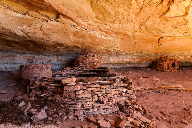
Owl Creek Alcove by IntrepidXJ, on Flickr
There were also some pictographs painted on the ceiling of the alcove.
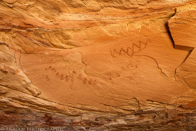
Paintings by IntrepidXJ, on Flickr
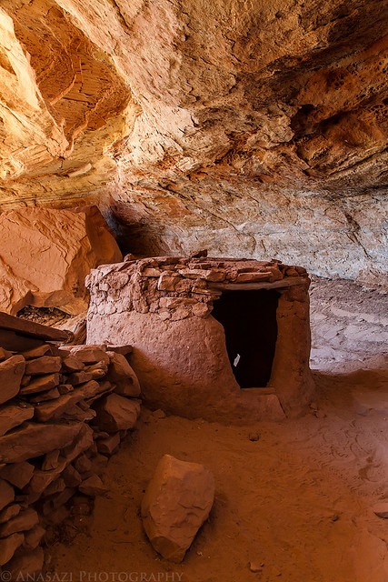
Small Room by IntrepidXJ, on Flickr
Comments Off on Cedar Mesa & Bluff | posted in Adventures, Anasazi, Camping, Hiking, Photography, Rock Art, Trip Reports
Apr
30
2012
Saturday & Sunday, April 7-8, 2012
I set out this weekend with one goal in mind- I was searching for a specific ruin known as the Painted Granary or Nestled Granary. I had done some research and thought I figured out which canyon it might be hidden in. The only way to know for sure was to get out there, hike around and search for it…so that’s what I did!
While trying to find a way into the canyon, I came across these ‘bird tracks’ in a very shallow alcove.
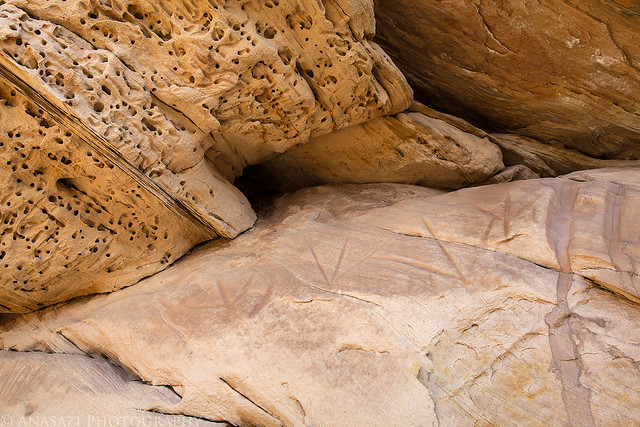
Bird Tracks by IntrepidXJ, on Flickr
Eventually I managed to find my way into the mouth of the canyon and started hiking upstream while searching the canyon walls for ruins. I hadn’t hiked very long when I spotted the ruin I was looking for…I was excited to find it and scrambled up the loose talus slope to reach it. There were a few other ruins below it that weren’t in as good of shape.
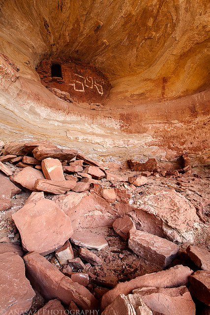
Ruins Below by IntrepidXJ, on Flickr
There was also one nice reverse handprint painted on the sandstone inside the large alcove. There were a couple other one’s that were pretty faint and hard to see, too.
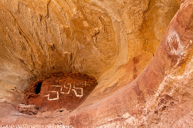
Hand & Painted Granary by IntrepidXJ, on Flickr
Comments Off on Easter Weekend Ruins & Rock Art | posted in Adventures, Anasazi, Camping, Hiking, Photography, Rock Art, Trip Reports
Sep
15
2011
September 10-11, 2011
The White Rim Trail seems to be the one I just can’t complete. I’ve been wanting to for years, but it just never seems to happen. The first big issue for me is getting a permit to camp along the trail (yes, I know I could probably get around the full trail in a day if I wanted, but I would prefer to enjoy it and not rush through it). I dislike planning my weekend trips too far in advance, so in the past I have always just never bothered to try to get a permit. Finally, last year I decided I really was going to try and get a permit so that I could drive the trail near the end of the year. Unfortunately, a storm managed to wash out the Mineral Bottom switchbacks making a complete loop impossible for a while. Once they repaired the switchbacks earlier this year I actually managed to reserve a permit for September. Who knew that the Green River would flood for much of the spring and summer and the road would again be closed? I was hoping Canyonlands would open the road right before our trip this last weekend, but thanks to anothe storm causing some damage to the switchbacks again on Friday, it just wasn’t in the cards this time. We decided to drive to our campsite at Murphy Hogback on Saturday and then drive back out the same way on Sunday. Even though we didn’t get to complete the full loop, we had a great time and am glad we still went. I guess there’s always next year to try again! On a side note, the park opened up the complete loop again on Tuesday…..we were just a few days too early….oh well!
Maybe you’ll be pleasantly surprised to find out that there is not going to be any rock art photos in this trip report! It was actually kind of nice to get back into taking photos of the landscape and my Jeep. Enjoy the photos!
Shafer Trail
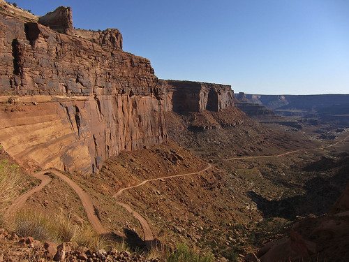
A few of the switchbacks on the Shafer Trail that take you down to the White Rim from the Island in the Sky.
Colorado River Overlook
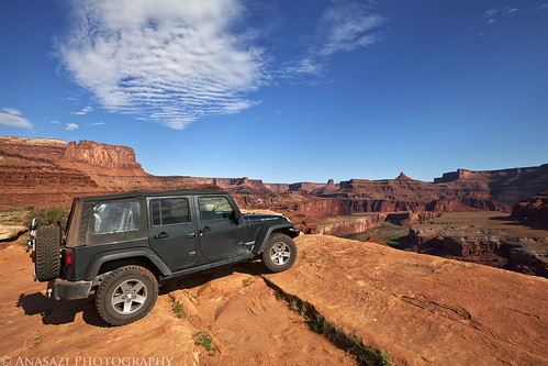
We stopped at the Colorado River Overlook across from the The Gooseneck.
White Rim Trail
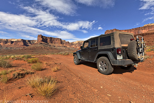
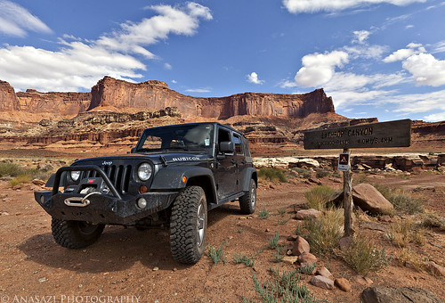
My Jeep on the White Rim Trail headed towards the Island in the Sky.
Descending Towards the Airport
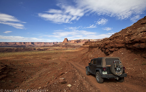
Following the road down towards Airport Tower.
Head of Lathrop
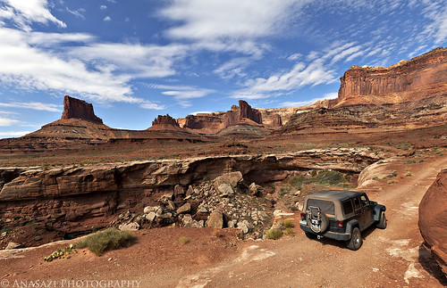
This road would be much shorter if it didn’t have to avoid many deep canyons along the route. Here it loops around the head of Lathrop Canyon.
Colorado River
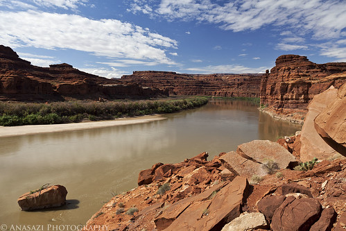
We took the side trip down Lathrop Canyon to the Colorado River. We saw no one on the river while we were there. I’d love to float this section of the river in the future!
Lathrop Canyon Intersection
Back at the signed intersection for Lathrop Canyon and the White Rim.
On the Edge
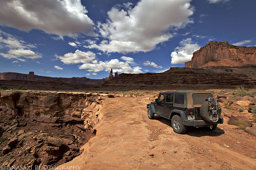
Skirting around another deep canyon cut into the White Rim. Washer Woman Arch and Monster Tower can be seen in the distance. We also spotted Mesa Arch from the trail (not visible in any photos I have posted) which looked tiny from below.
White Rim View
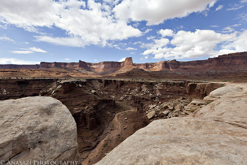
View down into a deep chasm with the Island in the Sky in the background.
Continue reading
2 comments | posted in Adventures, Camping, Hiking, National Parks & Monuments, Photography, Trip Reports
May
9
2011
The Maze and the Mesa (April 2011)
Day 9: Long Fingers Canyon
Sunday, April 17, 2011
The last day of our 9 day trip had finally arrived and I was looking forward to getting home and taking a real shower. We wanted to make this a shorter day so that we wouldn’t be getting home too late. We broke down camp, had a quick breakfast and then we crossed over Comb Ridge and headed south along Butler Wash. Then we hiked into Long Fingers Canyon and explored all of the alcoves, ruins and rock art that we could find. It was a nice and easy hike with a lot to see and explore. It’s amazing how many large alcoves this short canyon contains!
To the Comb

Hiking along the ‘now closed’ road towards Comb Ridge and Long Fingers Canyon.
White Hands
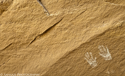
The first large alcove we came to had a set of white handprints on the back wall.
Red Figure
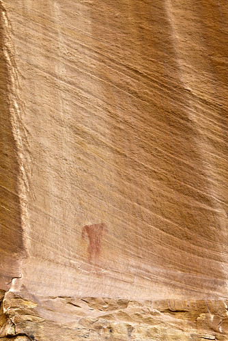
As we neared the Long Fingers Ruins we passed a number of faint petroglyphs and pictographs. I spotted this faint red anthropomorph high above.
Flying Target
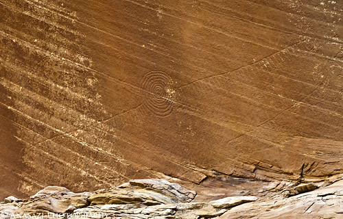
This is certainly one of the more unique petroglyphs I have come across. I’ve never seen anything like it before. It was hard to get a good shot of it, but I think this one turned out OK.
Stick Figure

Another of the faint petroglyphs on the way to the ruins.
Pregnant Stick Figure
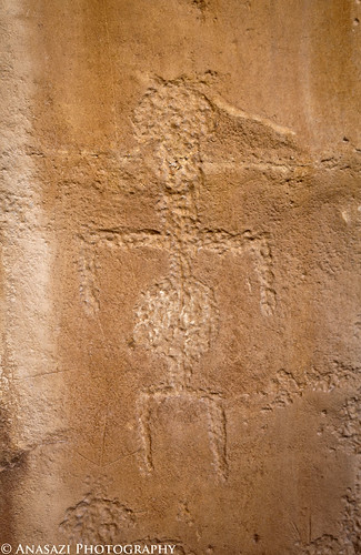
Here’s another stick figure that has a round middle section….my guess would be representing pregnancy.
Metate Designs
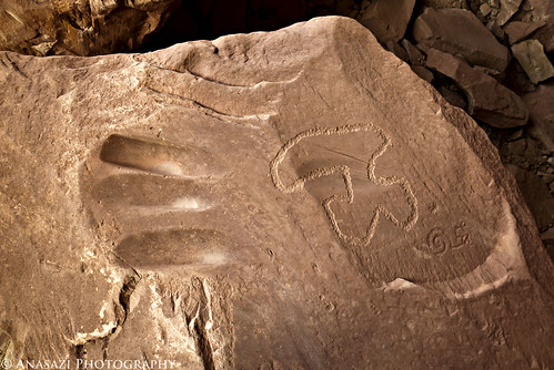
This boulder has a few interesting petroglyphs and a couple of metate grooves.
Jared in the Alcove

Jared exiting the deep alcove below the ruins.
Continue reading
1 comment | posted in Adventures, Anasazi, Camping, Hiking, Photography, Rock Art, Trip Reports
May
4
2011
The Maze and the Mesa (April 2011)
Day 8: Mule Canyon
Saturday, April 16, 2011
On Saturday we woke up again to yet another cold morning, but thankfully not quite as cold as the previous day. Originally we were planning on staying in our current campsite for the last night, but at the last minute we changed our plans and decided to move to Comb Wash for the last night. We packed up camp and headed over to Comb Wash and then setup camp again. Once camp was set, we headed over to Mule Canyon and were hoping to take a nice leisurely stroll up the canyon for an easy day of exploring……but as I stated before, is seems Jared and I don’t quite know the meaning of an ‘easy day’ because by the time we reached the Jeep again we had hiked over 8.5 miles round trip with a lot of climbing up to ruins along the way.
Of course we visited the House on Fire (Flaming Roof) ruins, and then we continued up the canyon a few more miles searching for other ruins and rock art as we went. I know we missed some of them, probably because we turned around too soon, so I’m sure I’ll be heading back again sometime in the future 😉
Flaming Roof
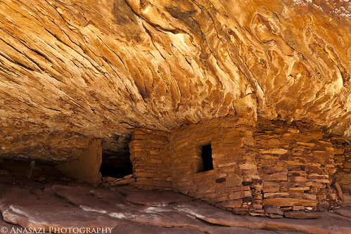
Curved Flames
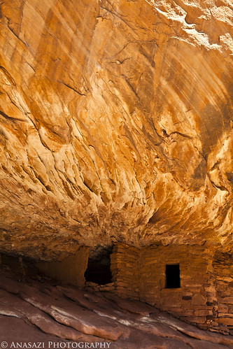
House on Fire Overview
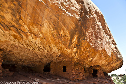
An overview of the House on Fire ruins.
Mule Canyon Wall
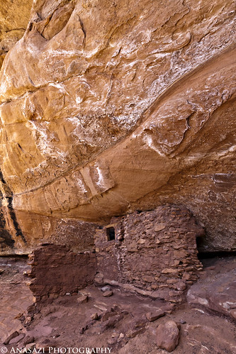
The next set of ruins we found up the canyon from House on Fire.
Mule Canyon
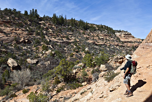
Jared and the view up Mule Canyon.
High Ruins Overview
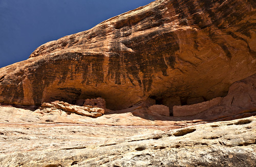
A well-preserved set of ruins further up.
High Ruins
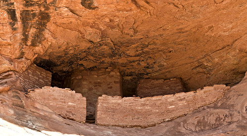
A closer look at the ruins since we didn’t even try to find a way up to them since there was no obvious route.
Resting Tree
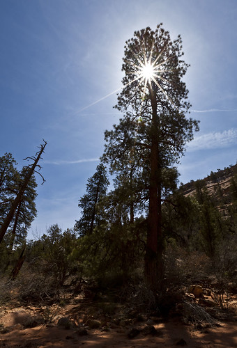
When we reached the spot in the canyon we turned around at, I stopped to rest in the shade of this tree and took this photo as I lay on the cool sandstone.
On our way back down Mule Canyon we stopped and climbed up to one more site we had skipped on the way up. I’m glad we did, since there turned out to be some cool rock art, too.
Circles and Stripes
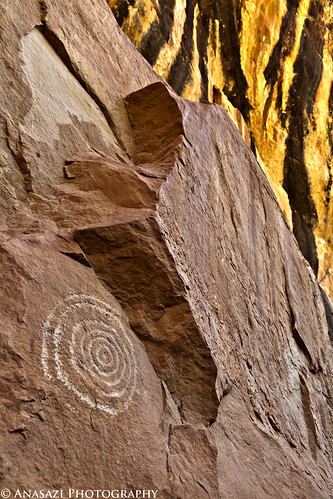
The top of the alcove glows bright orange in the background with the large concentric circles in the foreground.
Paint and Petroglyphs
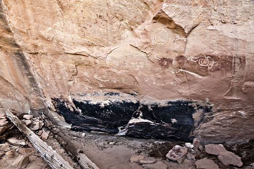
Here we found another painted wall that used to be in the back of a structure. There are plenty of petroglyphs located above the paint, too.
Continue reading
2 comments | posted in Adventures, Anasazi, Camping, Hiking, Photography, Rock Art, Trip Reports


