Jul
3
2012
Saturday, June 30, 2012
At 14,309 feet, Uncompahgre Peak is the highest point in the San Juan Mountains and the 6th highest in Colorado. It was also our destination this morning.
After work on Friday, Jackson and I loaded up my Jeep and headed south to the San Juan’s. We made a quick stop for dinner in Montrose and then we were soon passing through Ouray and turning off the highway on the rough road following the Uncompahgre River and Mineral Creek. Next we found ourselves driving at just under 13,000 feet as we crossed Engineer Pass and dropped back down along Henson Creek. When we reached the rough road that follows Nellie Creek we turned onto it and climbed a few thousand feet again until we had reached the boundary for the Uncompahgre Wilderness area and the trailhead to Uncompahgre Peak. We quickly setup camp in what was left of the twilight and got to bed early.
Bright and early on Saturday morning we were up and having a quick breakfast before starting the hike. As we entered the wilderness our surroundings were still in the shadows, but occasionally we would catch a glimpse of Uncompahgre Peak lit up with a golden early morning light. Next time I will have to get an earlier start so I can take a few photos of that (and also bring along my DSLR).
Uncompahgre Peak lit up with golden light on a cloudless morning.
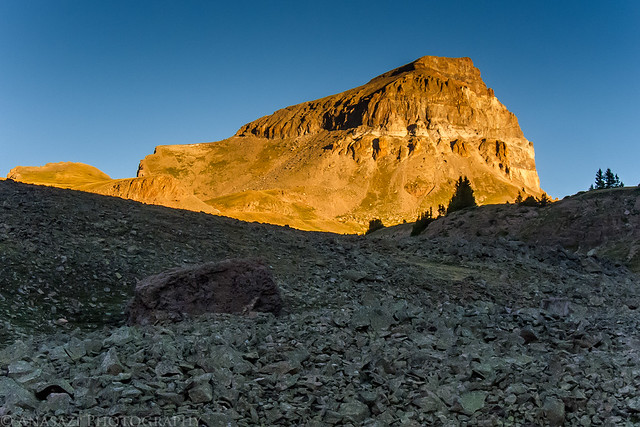
Uncompahgre Sunrise by IntrepidXJ, on Flickr
Uncompahgre Peak…that way!
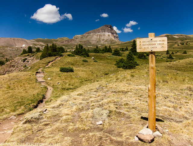
Intersection by IntrepidXJ, on Flickr
Easy trail through the alpine tundra.
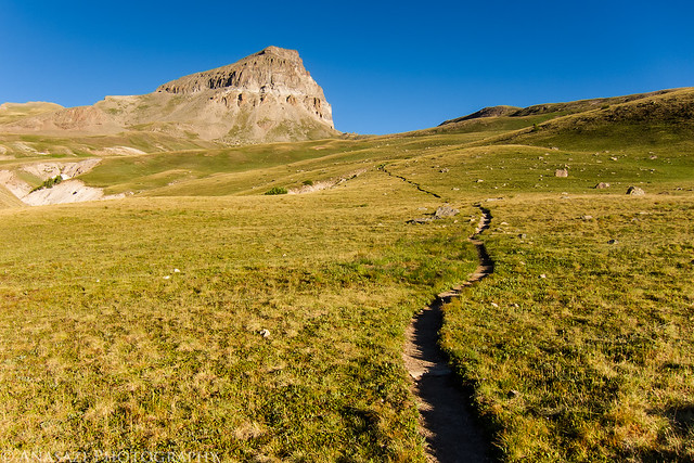
Path to Uncompahgre Peak by IntrepidXJ, on Flickr
Comments Off on Uncompahgre Peak | posted in 14ers, Adventures, Camping, Hiking, Mountaineering, Summits, Trip Reports
Jul
2
2012
Saturday & Sunday, June 23-24, 2012
After spending a few hours in the morning at the Shavano Valley Petroglyph Park near Montrose, we continued driving into the San Juan Mountains to get out of the heat for the weekend. Shortly after crossing over Red Mountain Pass we turned down the road along the South Fork of Mineral Creek and found a campsite for the weekend. After setting up our camp we drove through Silverton and made our way up Cunningham Gulch to the trailhead for the Highland Mary Lakes. As soon as we passed through Silverton the valley started filling up with smoke, and by the time we reached the Cunningham Trailhead the smoke had become pretty thick and there was even a little ash falling from the sky. We would later learn this smoke was from a wildfire that had started near Mancos.
A view of the smoke in Cunningham Gulch from the trailhead.
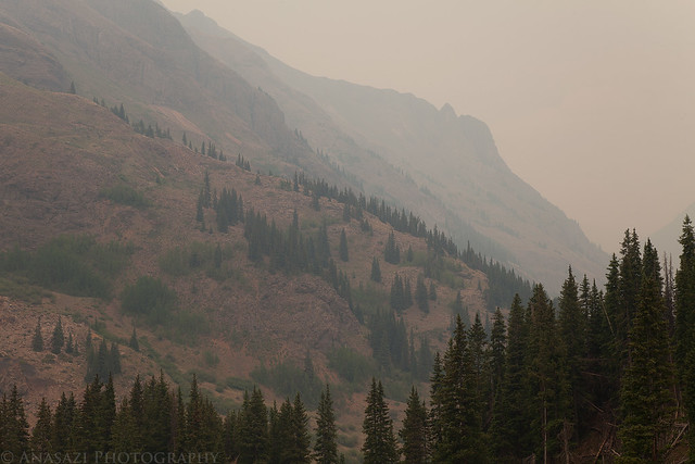
Smoke in the Gulch by IntrepidXJ, on Flickr
Entering the Weminuche Wilderness.
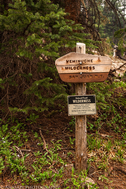
Weminuche Wilderness by IntrepidXJ, on Flickr
Smoke fills the sky with a view of the trail below through some pine trees.
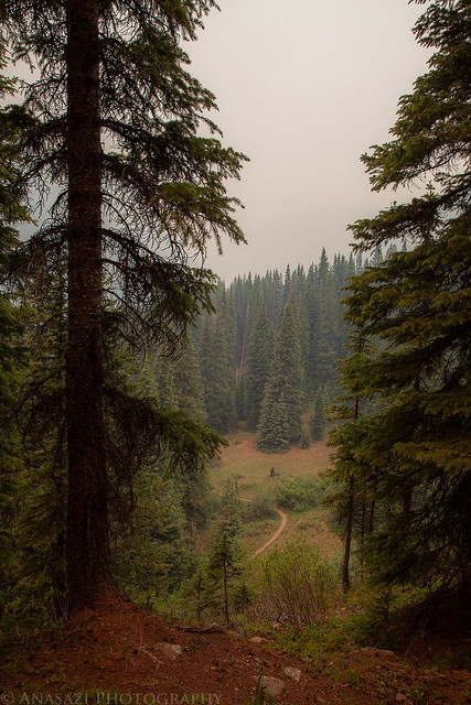
Trail Below, Smoke Above by IntrepidXJ, on Flickr
Comments Off on Beating the Heat in the San Juan Mountains | posted in Adventures, Camping, Hiking, Photography, Trip Reports
Jul
2
2012
Saturday, June 23, 2012
On Saturday I was invited by my friend Greg to visit the Shavano Valley Petroglyph Park near Montrose. I’ve been wanting to visit this site for quite a while, but never got around to getting permission to go, so I jumped at the opportunity. Amanda and I planned to head back up into the San Juan Mountains again this weekend, so it worked out perfectly since we would be driving through Montrose on our way. We left Grand Junction very early so we could meet Greg at the park around sunrise. We ended up spending a few hours searching the cliff faces for petroglyphs and taking photos. Here are a few photos of the petroglyphs…
Our favorite petroglyphs at the site were at the Bear Dance Panel.
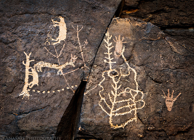
Ute Bear Dance by IntrepidXJ, on Flickr
A closer look at the bear climbing a tree petroglyph. Very unique and cool!
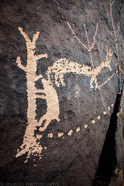
Bear in a Tree by IntrepidXJ, on Flickr
This was another large panel of petroglyphs next to the Bear Dance Panel.
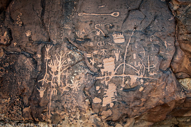
Big Panel by IntrepidXJ, on Flickr
Comments Off on Shavano Valley Petroglyph Park | posted in Adventures, Hiking, Photography, Rock Art, Trip Reports, Ute
Jul
1
2012
Saturday & Sunday, June 16-17, 2012
Amanda has been wanting to get back into the mountains for a while, so that’s where we went this weekend. Saturday morning we left the heat of the Grand Valley behind and drove up into the San Juan Mountains. Back in 2009 I visited an area called Gray Copper Gulch situated between the Red Mountains and Brown Mountain. I have wanted to get back up there again to take some new photos and figured this weekend would be a great time. After driving through Ouray we drove over Corkscrew Pass and then into Gray Copper Gulch. We found a nice campsite between a few of the ponds that I wanted to photograph.
When we arrived in Gray Copper Gulch, clouds were rolling in and the wind was blowing pretty good, as you can tell from the ripples in the water.
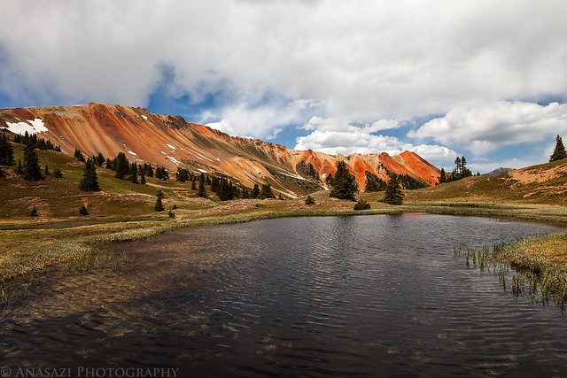
Ripples & Clouds by IntrepidXJ, on Flickr
Camp setup with Red Mountain #1 in the background.
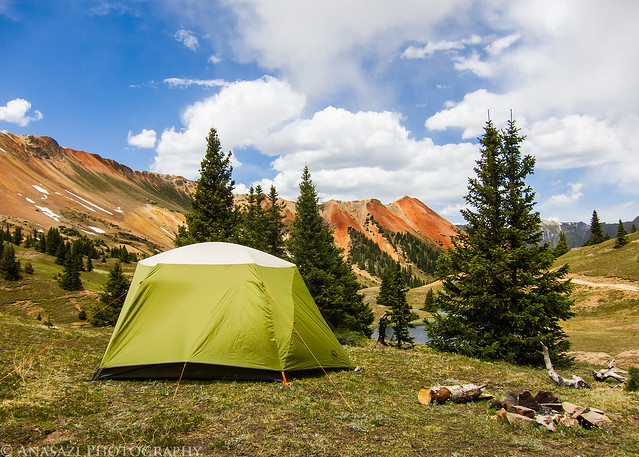
Home for the Night by IntrepidXJ, on Flickr
Once our camp was setup we left Gray Copper Gulch to drive a few of the high passes in the area.
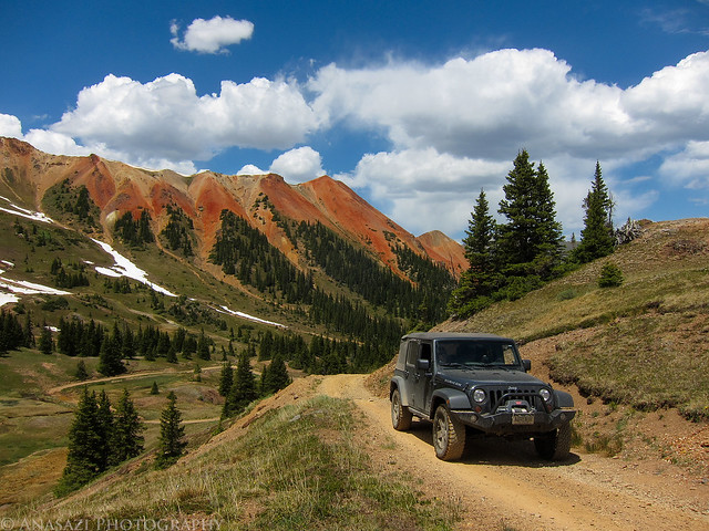
Leaving Gray Copper Gulch by IntrepidXJ, on Flickr
Comments Off on Gray Copper Gulch | posted in Adventures, Camping, Hiking, Photography, Trip Reports
Jun
22
2012
Friday – Sunday, June 8-10, 2012
This weekend I met my friend Philippe and his wife on their annual trip to the Southwest from France. This year we planned a day to do a little hiking and exploring on Cedar Mesa (Last year we spent a day hiking in the San Rafael Swell). We spent Saturday hiking together and searching for a few ruins and rock art sites. That evening I ended up camping at their campsite in Natural Bridges. We also had an unexpected visitor to camp that evening when Laurent Martres and one of his friends stopped by. It was nice to meet him since I used his Photographing the Southwest books when I first started getting into photography a few years ago. We also got to see a sneak peek of a new book he will be publishing soon. On Sunday I went off on my own to do a little more exploring before heading back home. Here are plenty of photos from the weekend in no particular order.
After work on Friday I drove down to the Mule Canyon Towers and set up camp nearby. I managed to get there just as the sun was setting and striking one of the towers.
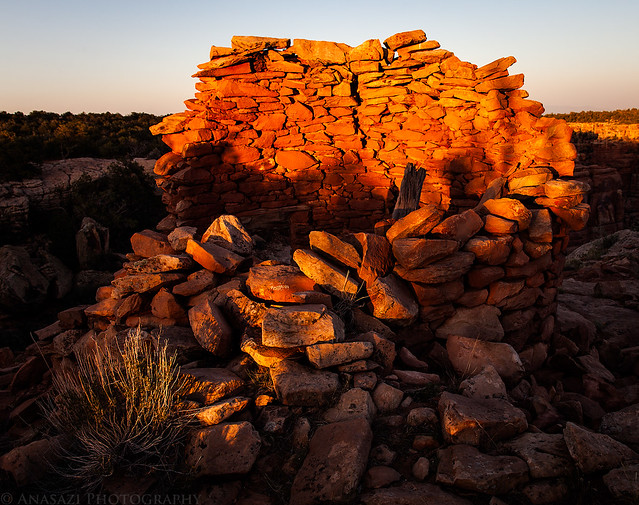
Cave Tower Sunset by IntrepidXJ, on Flickr
Philippe taking photos of the Bigfoot Ruins. The ruins are named the Bigfoot Ruins because there is a footprint in the mud next to the doorway of one of the structures.

Philippe and the Bigfoot Ruins by IntrepidXJ, on Flickr
A pile of potsherds found at the Bigfoot Ruins.
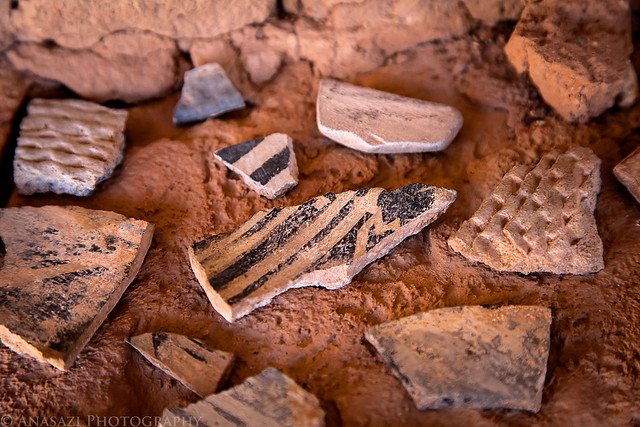
Bigfoot Potsherds by IntrepidXJ, on Flickr
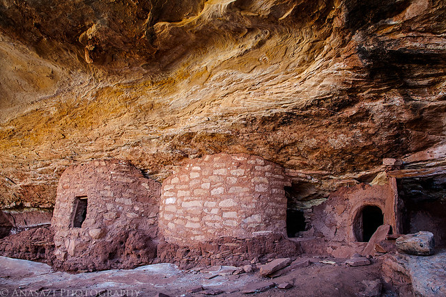
Bigfoot Ruins by IntrepidXJ, on Flickr
Comments Off on Cedar Mesa Ruins & Rock Art | posted in Adventures, Anasazi, Camping, Hiking, National Parks & Monuments, Photography, Rock Art, Trip Reports


