Oct
24
2011
Arizona Strip & Southern Utah Wanderings | Day 4
Tuesday, October 4, 2011
After the previous day’s late adventure we decided to take things easy and relax on our fourth day of the trip. We started off by sleeping in and then went to Nedra’s Too for some breakfast. I have to say that they served one of the best breakfasts I have had in a long time and the service was great. I would highly recommend this place to anyone looking for a place to eat in Kanab. While having breakfast, Jared and I figured out our plans for the rest of the day. First up, we took a drive over near the Coral Pink Sand Dunes and Moquith Mountain so that we could visit the South Fork Indian Canyon Pictographs.
After a short hike down into the canyon from above we reached the developed rock art site.
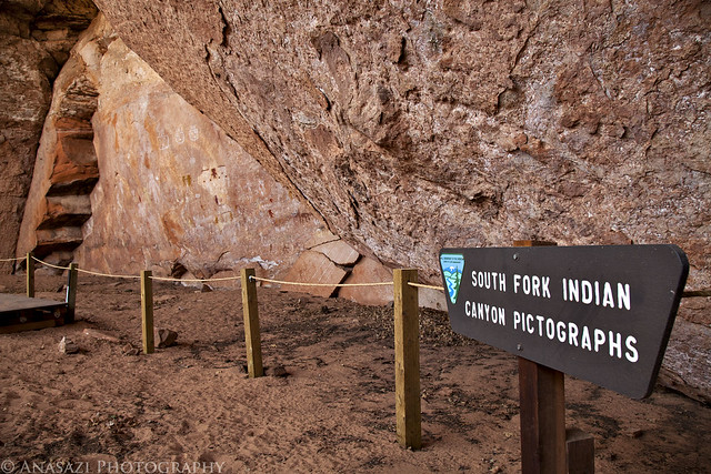
South Fork Indian Canyon Pictographs by IntrepidXJ, on Flickr
A few of the interesting pictographs found here including the Yellow Twins and a small red square-headed anthropomorph. It also appears that there may have been two larger white figures on each side of the small red one, but only the head, arm and part of the torso of the one on the right remains.
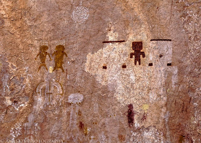
Yellow Twins & Square Man by IntrepidXJ, on Flickr
Hidden in a crack on the right side of the alcove were a few more hard-to-see pictographs. The interesting thing about these is that they appeared to have been painted blue, which isn’t too common of a color to find in pictographs.
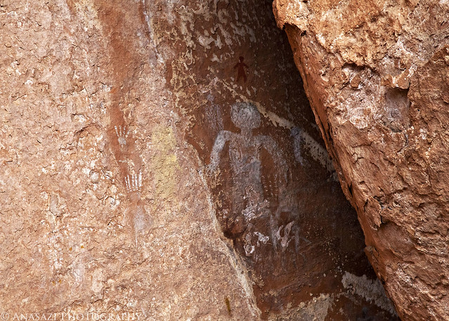
Hidden by IntrepidXJ, on Flickr
Comments Off on South Fork Indian Canyon Pictographs | posted in Adventures, Anasazi, Hiking, Photography, Rock Art, Trip Reports
Oct
21
2011
Arizona Strip & Southern Utah Wanderings | Day 3
Monday, October 3, 2011
After a good night of sleep, we woke up on Monday morning early enough so that we could drive back over to the overlook at Toroweap and catch the sunrise. We set up our cameras at a viewpoint overlooking the Grand Canyon to the East.
The sun just peeking over the horizon with a great view down into the Grand Canyon.
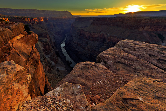
Sun-Kissed Canyon by IntrepidXJ, on Flickr
After taking some photos looking East, Jared and I headed over to get a view towards the West.
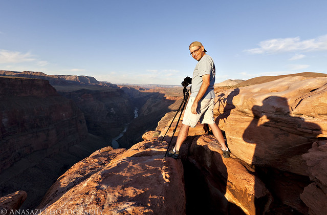
Jared at Toroweap by IntrepidXJ, on Flickr
Jared taking his shot.
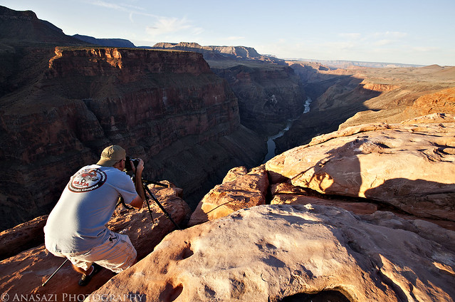
Taking the Shot by IntrepidXJ, on Flickr
Once we were done photographing the sunrise, we packed up camp and left Toroweap behind.
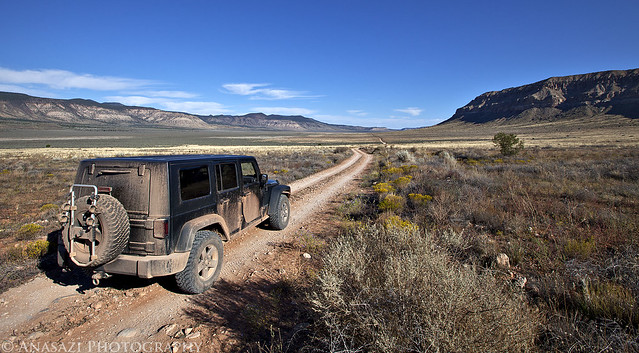
Leaving Toroweap by IntrepidXJ, on Flickr
1 comment | posted in Adventures, Hiking, History, National Parks & Monuments, Photography, Rock Art, Trip Reports
Oct
19
2011
Arizona Strip & Southern Utah Wanderings | Day 2
Sunday, October 2, 2011
After an awesome night camping under the stars in perfect weather near Little Black Mountain, we were up early, had a little breakfast and were soon on our way back into Utah. Our ultimate destination for the day would be Toroweap on the North Rim of the Grand Canyon, but we would have a lot of exploring to do on our way there.
After entering Utah again, we quickly found ourselves in Warner Valley. As we headed east, we took the short detour to Fort Pearce which is located along the old Honeymoon Trail.
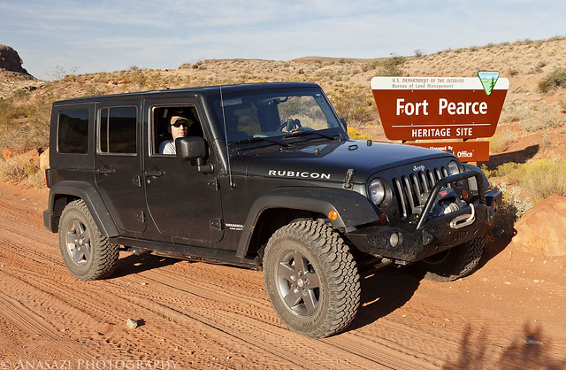
Fort Pearce Heritage Site by IntrepidXJ, on Flickr
Of course, our first objective at the site was to find the petroglyphs located near the fort. They were easy to find and the area offered a nice view.
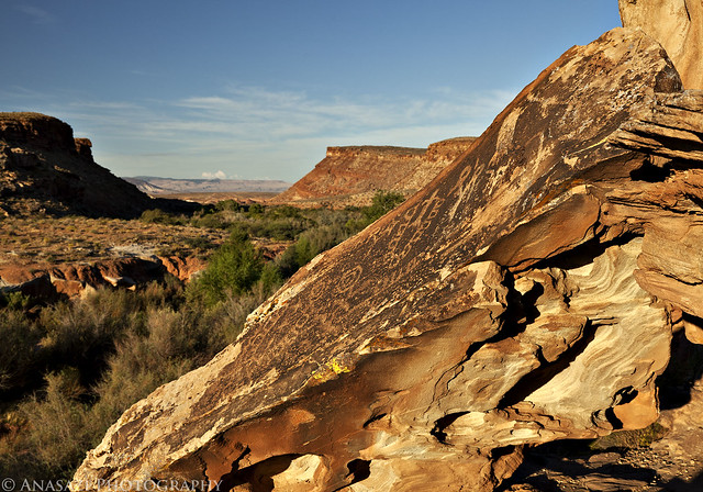
Fort Pearce Petroglyphs by IntrepidXJ, on Flickr
A closer look at the petroglyphs on the slanted boulder.
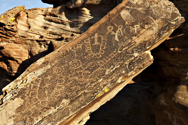
Fort Pearce Boulder by IntrepidXJ, on Flickr
Comments Off on Straddling the Border to Toroweap | posted in Adventures, Anasazi, Dinosaur Tracks, Hiking, History, National Parks & Monuments, Photography, Rock Art, Trip Reports
Oct
18
2011
Arizona Strip & Southern Utah Wanderings | Day 1
Saturday, October 1, 2011
Saturday was the start of my annual ‘Southern Utah Wanderings’ trip that I usually go on in October. This year is a little different since I wanted to venture a little further south so that I could start exploring the Arizona Strip. Like last year, my friend Jared joined me on this trip. He headed down from the Salt Lake area after work on Friday and stayed at my house over night so that we could get an early start driving on Saturday morning.
Saturday would mostly be a driving day, but we did manage to make a few stops along the way. The first of them being a short side trip to the Parowan Gap. The Parowan Gap is one of Utah’s best-known petroglyph sites, which is located in a 600-foot-deep notch through the Red Hills on the eastern edge of the Escalante Desert. I’ve been looking forward to visiting this site for some time.
The ‘Zipper-Glyph’ is probably the most well known petroglyph panel at the site. Some believe the main design that resembles a zipper is a map or a calendar….or maybe even both. All I know is that it is shaped just like the Parowan Gap that it is located near.
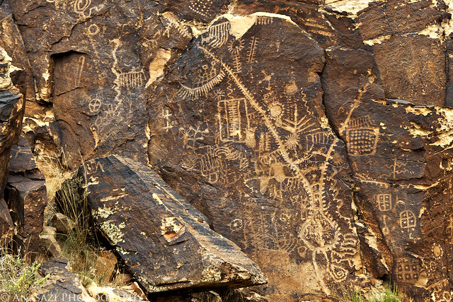
Zipper-Glyph by IntrepidXJ, on Flickr
A closer look at another petroglyph panel located next to the ‘Zipper-Glyph’
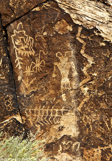
Snake-Man by IntrepidXJ, on Flickr
We walked through the gap keeping a lookout for petroglyphs along the way. When we reached the west side, this is the last boulder we found containing some petroglyphs.
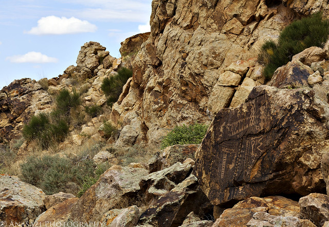
West Boulder by IntrepidXJ, on Flickr
Comments Off on Parowan Gap & Little Black Mountain | posted in Adventures, Hiking, Photography, Rock Art, Trip Reports
Sep
26
2011
Friday, September 23, 2011
After work on Friday, Amanda and I headed down to Moab to meet a few friends at the Moab Brewery for a birthday party and some burgers. After dinner we hiked up to the Moab Maiden in the dark so that I could attempt some night photography there again. Here’s a few of my photos from the night.
Under the Dipper

This is probably my favorite photo from Friday. I was able to frame the shot so that the Big Dipper was right over the large boulder containing the petroglyph.
Milky Way Princess
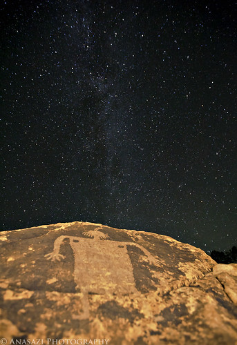
This one didn’t turn out as well as I had hoped, so I guess I will have to try again sometime in the future.
Maiden Star Trails
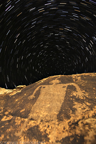
I have taken a photo of the Moab Maiden with star trails before, but I wanted to attempt the shot again. I think this one turned out better than the last, but I’m still not entirely happy with it. Either way, we had a nice evening examining the skies. We even spotted a few shooting stars.
2 comments | posted in Adventures, Hiking, Photography, Rock Art, Trip Reports


