Oct
26
2012
Arizona Strip & Southern Utah Wanderings | Day 4
Tuesday, October 9, 2012
Since there weren’t really any good places nearby to photograph sunrise, we slept in a little later on Tuesday morning. After a little breakfast we packed up camp and took the rough Jeep road to it’s end where we would start our hike. Our destination for today would be to the top of Flag Point in the Vermilion Cliffs of the Grand Staircase. Jared and I had wanted to try this hike last year, but were unable to squeeze it in. From what I understand, most people that have made this trek hike up from the base of the cliff and are able to find a way up, however we thought that we would try to hike from the backside. It was probably a longer hike, but it involved less steep climbing.
The view towards Kanab from the top of Flag Point.
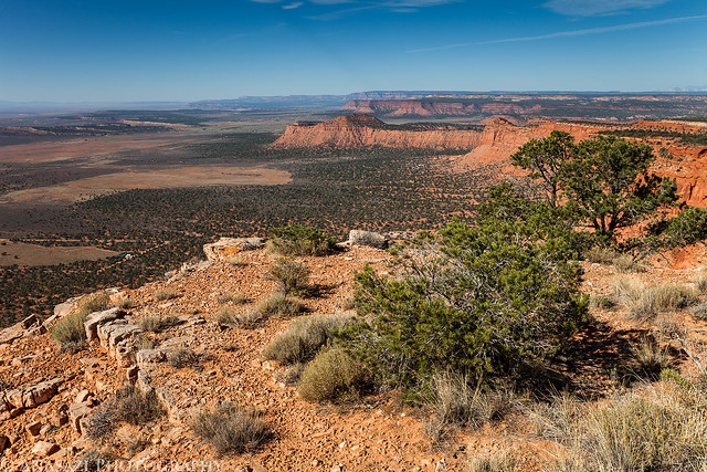
Flag Point View by IntrepidXJ, on Flickr
After visiting the point we started hiking along the rim in search of a dinosaur track site.
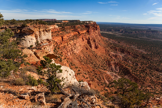
Rim Hiking by IntrepidXJ, on Flickr
Jared taking a photo looking back at Flag Point.
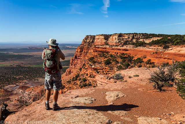
Leaving Flag Point by IntrepidXJ, on Flickr
Comments Off on Flag Point | posted in Adventures, Anasazi, Camping, Dinosaur Tracks, Hiking, National Parks & Monuments, Photography, Rock Art, Trip Reports
Oct
24
2012
Arizona Strip & Southern Utah Wanderings | Day 3
Monday, October 8, 2012
On Monday morning we got up early and wandered over to The White Pocket again to catch the sunrise. We arrived plenty early to try and catch the pre-sunrise glow, which was amazing!
There’s sometimes an amazing glow that really brings out the colors in the sandstone about 10-20 minutes before sunrise. You can see it with your eyes, but a long exposure really brings it out in your photos.
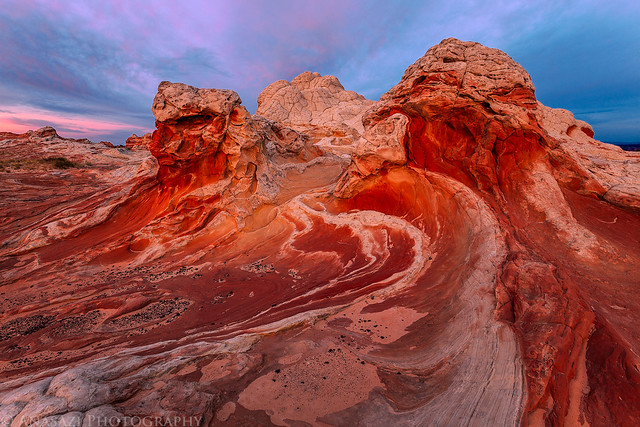
Radiate by IntrepidXJ, on Flickr
Interesting shapes and lines in this formation and nice clouds in the sky. We couldn’t have asked for better conditions.
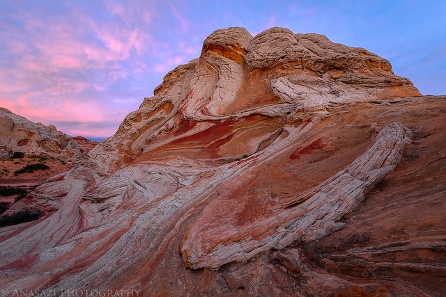
Awake by IntrepidXJ, on Flickr
White Pocket Butte lights up with alpenglow right before the sun comes up.
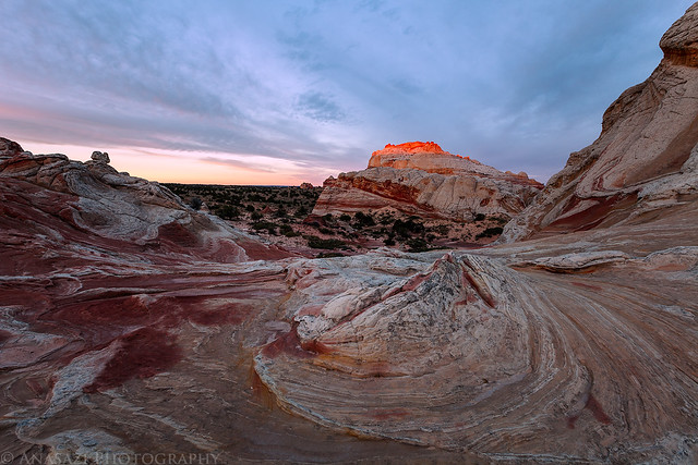
White Pocket Alpenglow by IntrepidXJ, on Flickr
2 comments | posted in Adventures, Anasazi, Camping, Hiking, National Parks & Monuments, Photography, Rock Art, Trip Reports
Aug
15
2012
Saturday & Sunday, August 4-5, 2012
On Saturday I met up with Jackson and his family so that we could float a section of the Green River known as the Green River Daily. This section is a few miles long and located within Gray Canyon a few miles north of the town of Green River. There aren’t really any big rapids on this stretch of the river, especially at this year’s very low water flows, so we were just expecting a nice relaxing float with a lot of swimming to stay cool. I also hoped to find some new petroglyphs along the way.
After dropping off my Jeep at the Swaseys Rapid takeout, we continued in Jackson’s Prius to the put-in at Nefertiti. The last time I was on this road it had been freshly bladed and I don’t recall it being too rough, but unfortunately this time around it was a bit rocky and almost too much for the Prius. The most difficult part was through a few stretches of sand that he had to power through. Luckily, he somehow managed to get that little car to the end of the road without getting stuck or scraping up the bottom too badly. If he hadn’t, we would have been walking back to the Jeep and not getting on the river.
After reaching the put-in at Nefertiti, we got our boats setup under the shade of a large cottonwood tree.
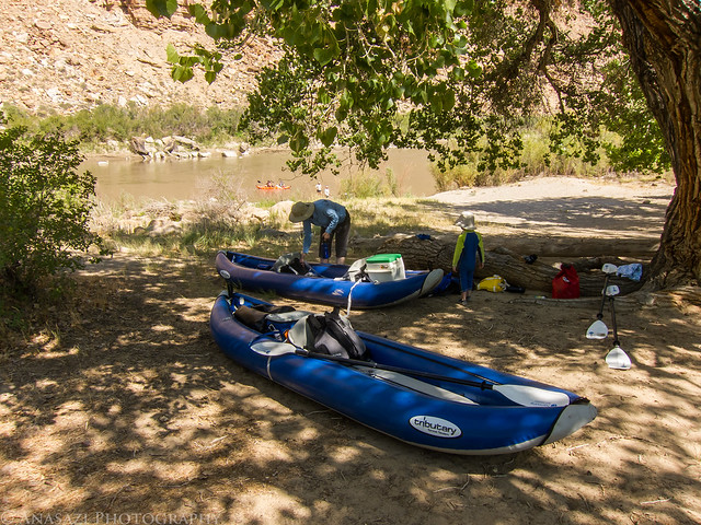
Getting Ready by IntrepidXJ, on Flickr
Ready to get on the river for the day.
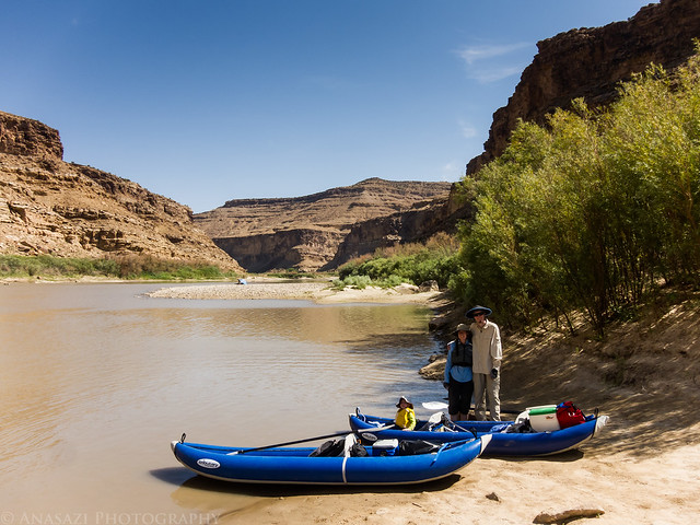
Ready to Launch by IntrepidXJ, on Flickr
Just around the first bend we paddled under the large Nefertiti Rock.
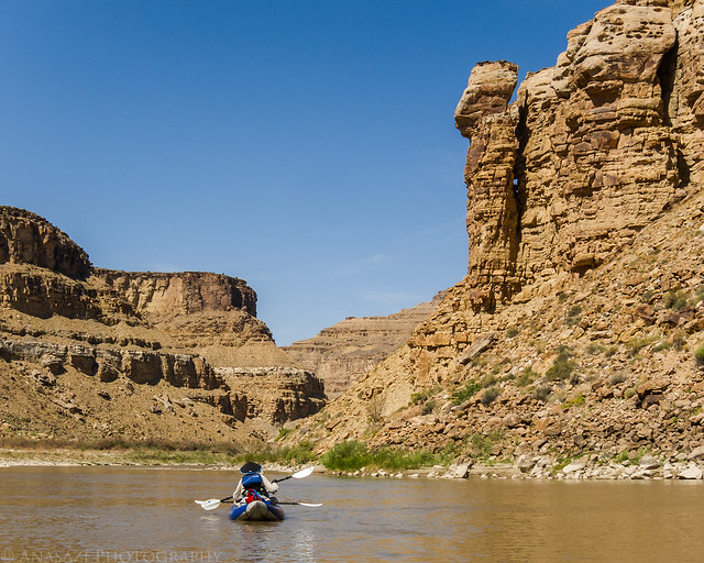
Below Nefertiti by IntrepidXJ, on Flickr
2 comments | posted in Adventures, Camping, Fremont, Hiking, National Parks & Monuments, Photography, Rafting, Rock Art, Trip Reports, Water Recreation
Jul
26
2012
Saturday & Sunday, July 14-15, 2012
I first tried to explore Horse Canyon in the Needles District of Canyonlands National Park back in 2008 when I camped at Peekaboo with a few friends. Back then the entrance to the canyon had been washed out pretty good and there was a very deep hole blocking vehicle entry. For the past two years I have been checking the condition of the road so that I could finally get back there to start exploring the area, but both the Salt Creek and Horse Canyon roads have been washed out and closed for that long. I have hiked up Salt Creek Canyon twice during those two years, but Horse Canyon was a bit too long for a day hike. A few weeks ago I finally received word that the National Parks Service had finally reopened the roads in Salt Creek and Horse Canyon, so I quickly made plans to get back. I reserved a campsite at Peekaboo for the weekend and invited Jared and Marty to come along.
After work on Friday, I drove down to Cottonwood Canyon and setup camp so that I would be close to Canyonlands in the morning and wouldn’t have to do much driving. There were a few rain showers in the evening, but the precipitation stopped before I went to bed, and I had a great night of sleep.
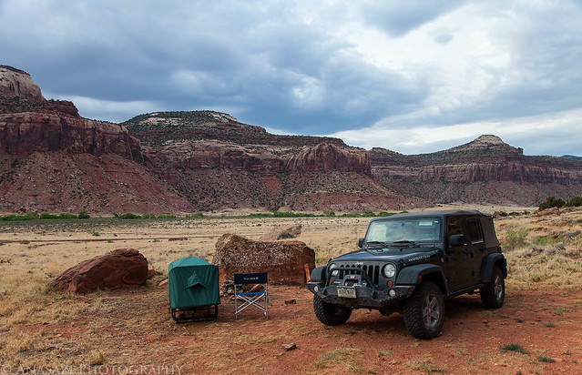
Good Morning by IntrepidXJ, on Flickr
In the morning I had a little time to photograph this ruin high up on the canyon wall. I have driven by this site many times and had not been able to find it before. It would have been a long hike up to reach it, but unfortunately I didn’t have the time this morning to try. I will have to return again to climb up to the ruin for some closer photos.
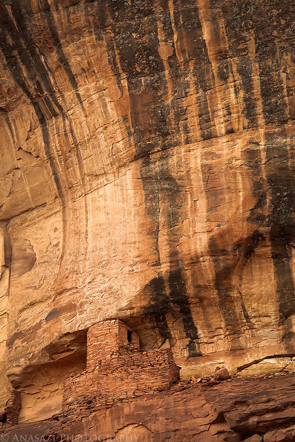
High Tower by IntrepidXJ, on Flickr
After photographing the tower, I continued my drive into the park where I met Jared and Marty at the Needle’s Visitor Center so that we could get our permits and the combination for the lock on the gate. Jared transferred his camping gear into my Jeep and parked his car at the trailhead before we continued through the locked gate into Salt Creek. The drive through the wash was in soft sand as usual, but the debris that had blocked the road in May had been removed. It was nice to be able to avoid this mosquito-infested area by closing the windows of the Jeep 😉 The deep holes that had blocked the entrance to Horse Canyon had also been filled in a bit. We drove through the holes and brush that was growing in the road and continued up Horse Canyon, where we would be spending much of the day searching for ruins and rock art.
We almost missed the remains of a tower near the mouth of the canyon. Good thing Marty spotted this one after we had passed it.
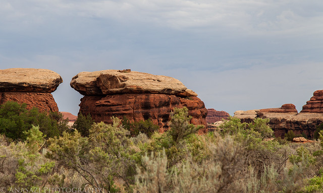
Watch Tower by IntrepidXJ, on Flickr
Comments Off on The Elusive Horse Canyon | posted in Adventures, Anasazi, Arches, Barrier Canyon Style, Camping, Hiking, National Parks & Monuments, Photography, Rock Art, Trip Reports
Jul
2
2012
Saturday, June 23, 2012
On Saturday I was invited by my friend Greg to visit the Shavano Valley Petroglyph Park near Montrose. I’ve been wanting to visit this site for quite a while, but never got around to getting permission to go, so I jumped at the opportunity. Amanda and I planned to head back up into the San Juan Mountains again this weekend, so it worked out perfectly since we would be driving through Montrose on our way. We left Grand Junction very early so we could meet Greg at the park around sunrise. We ended up spending a few hours searching the cliff faces for petroglyphs and taking photos. Here are a few photos of the petroglyphs…
Our favorite petroglyphs at the site were at the Bear Dance Panel.
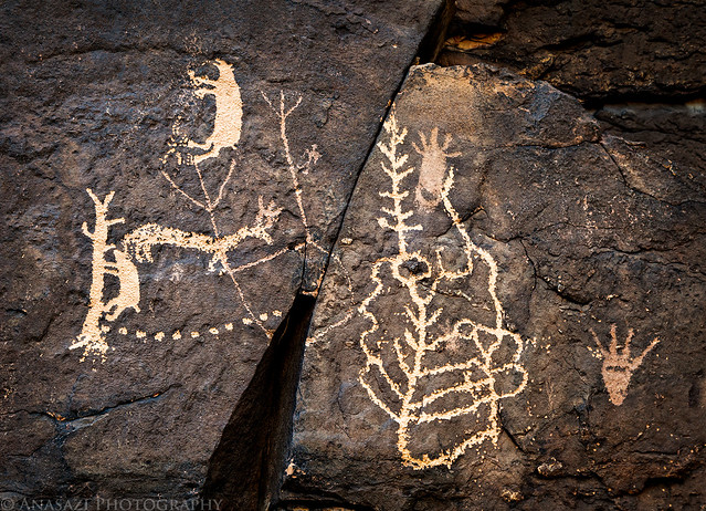
Ute Bear Dance by IntrepidXJ, on Flickr
A closer look at the bear climbing a tree petroglyph. Very unique and cool!
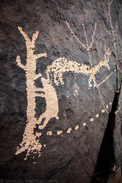
Bear in a Tree by IntrepidXJ, on Flickr
This was another large panel of petroglyphs next to the Bear Dance Panel.
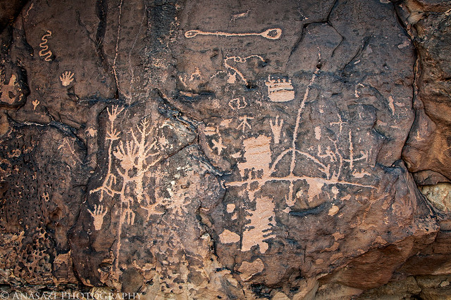
Big Panel by IntrepidXJ, on Flickr
Comments Off on Shavano Valley Petroglyph Park | posted in Adventures, Hiking, Photography, Rock Art, Trip Reports, Ute


