Aug
26
2008
 Klondike Bluffs (Moab, UT)
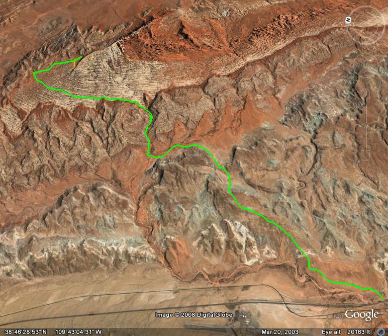
Klondike Bluffs is a moderate trail north of Moab that is not as popular as some of the other trails in the area. Because of this, you won’t encounter many other vehicles out of the trail usually. There is a large network of roads in the area that you can spend countless hours exploring.
Some of the highlights of this trail include some dinosaur tracks imprinted into the slickrock that are located right next to the trail. There is also a copper mine located on a short spur road at the end of the trail that you can check out and explore. This trail dead ends at the Arches National Park boundary, where you can hike up a little ways and get some great views of the Klondike Bluffs.
The start of this trail is an easy graded road, but does get a little rougher with a soft sandy wash, some narrow rocky sections of trail, and a medium sized crack in the slickrock that must be crossed. Any stock 4×4 with decent ground clearance should be able to handle this trail. After completing the trail, there is a connection road that you can take to get to the Tower Arch trail inside of Arches, plus you can follow the Copper Ridge trail nearby.
Please feel free to leave your comments and post your pictures from Klondike Bluffs below.
 Klondike Bluffs KML Track
(Right click and ‘Save Target As’)
Open file above in Google Earth.
Comments Off on Klondike Bluffs | posted in Trails
Aug
26
2008
 Black Sage Pass (Pitkin, CO)
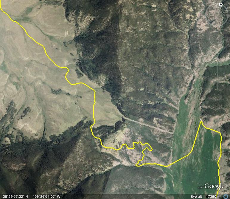
Black Sage Pass is one of many connecting trails in the area including Old Monarch Pass, Waunita Pass, Middle Quartz Creek and Tomichi Pass. You could easily spend a weekend or more exploring all of the trails in this area near Pitkin. There are also a number of nice campsites in this area for a weekend of exploring. Under dry conditions, passenger vehicles can handle this road.
When silver was discovered near Pitkin in the late 1870’s, this route provided a lower, but longer entryway into the area. By 1880, a stagecoach and freight wagons were using this route. The stagecoach continued to operate on this route into the late 1890’s.
Please feel free to leave your comments and post your pictures from Black Sage Pass below.
 Black Sage Pass KML Track
(Right click and ‘Save Target As’)
Open file above in Google Earth.
Comments Off on Black Sage Pass | posted in Trails
Aug
25
2008
 Los Pinos Pass (Doyleville, CO)
Los Pinos Pass is Spanish for ‘the pine trees.’ This is an easy trail that is useful if you are looking for a way to get from the Sawatch Range over to the San Juan Mountains without hitting the pavement. The Hayden Survey crossed this 10,200 foot pass back in 1874 and Otto Mears built the Saguache and San Juan toll road over the pass the same year.
Starting from US 50 in Doyleville, the trail starts out heading through relatively flat range land. Watch out for cattle in this section. This trail passes by Tomichi Dome and then crosses Colorado 114 before starting the gradual climb to the Pass. Shortly after the pass, it’s a short drive to Cathedral Junction, and then to Colorado 149 where you can head to either Lake City or Creede.
This trail is easy it’s entire way, and any high clearance vehicle should have no problems navigating it’s length. There are also a number of excellent camping locations closer to Cathedral Junction.
Please feel free to leave your comments and post your pictures from Los Pinos Pass below.
 Los Pinos Pass KML Track
(Right click and ‘Save Target As’)
Open file above in Google Earth.
Comments Off on Los Pinos Pass | posted in Trails
Aug
22
2008
 Miners Basin (Moab, UT)
Miners Basin is a short spur trail off of the La Sal Mountain Loop road that penetrates the densely forested northwestern slope of the La Sal Mountains and ends at Miners Basin. This basin was the site of the town of Miners Basin with a population of 100 at one point. This town serviced the nearby gold, silver and copper mines. Only 10 years after the towns establishment, The Basin began to fade as the mines in the area stopped producing.
While there are very few remains of the town that once survived in The Basin, there are still a few log cabins standing that you can hike to from the end of the trail. On the lower sections of the trail, you can catch a few panoramic glimpses between the pine and aspen trees of the canyon country below, and all the way back to the Book Cliffs. There are a few rocky sections and tight switchbacks on the trail, but nothing a stock 4×4 can’t handle. The trail ends at a small reservoir with a few campsites nearby.
Please feel free to leave your comments and post your pictures from Miners Basin below.
 Miners Basin KML Track
(Right click and ‘Save Target As’)
Open file above in Google Earth.
Comments Off on Miners Basin | posted in Trails
Aug
21
2008
 Hells Revenge (Moab, UT)
Hells Revenge is the classic Moab slickrock trail, and one of the more famous and popular trails in the area. Located in the Sand Flats Recreation Area, this trail is also very close to town off of the Sand Flats Road.
Not only does this trail offer great challenges for the driver, but also awesome scenery of the rolling slickrock with the La Sal Mountains in the background. There are also great views of Negro Bill Canyon, Abyss Canyon and a great overlook of the Colorado River. This trail includes some famous obstacles such as Hell’s Gate, Escalator, Car Wash, Mickey’s Hot Tub and Tip-Over Challenge.
This trail has it all. Most of the trail would be considered difficult as there are some dangerous steep climbs and descents throughout the trail, as well as some off-camber sections. Low gearing is certainly required for this trail. Good ground clearance and lockers would also be recommended.
This trail is either marked by black tire marks or painted flames on the slickrock. It crosses the Slickrock Bike trail a number of times which is marked by white dashes. Do not follow these white dashes. Hell’s Revenge is a must do trail for your Moab adventure.
Please feel free to leave your comments and post your pictures from Hells Revenge below.
 Hells Revenge KML Track
(Right click and ‘Save Target As’)
Open file above in Google Earth.
Comments Off on Hells Revenge | posted in Trails
![]() Klondike Bluffs KML Track
Klondike Bluffs KML Track


