May
16
2008
 Tincup Pass (Buena Vista, CO)
Tincup Pass is a very scenic high-elevation route that takes you between two very cool historic Colorado towns. St. Elmo is one of the most popular ghost towns in Colorado and at one time had a population of about 2000, while Tincup is a small residential community with a number of century old buildings.
I combined this trail with Hancock Pass (including the Alpine Tunnel) and Cumberland Pass to make a big loop, which makes for a nice long day of wheeling and exploring. I started this trail from the town of Tincup after having a nice lunch at Frenchy’s Cafe. After passing by Mirror Lake, you eventually work your way up to the pass and then back down to finish at St. Elmo. Much of the trail is easy, with a few bumpy parts with a section of shelf road near the pass.
Please feel free to leave your comments and post your pictures from Tincup Pass below.
 Tincup Pass KML Track
(Right click and ‘Save Target As’)
Open file above in Google Earth.
1 comment | posted in Trails
May
15
2008
 Owl Creek Pass (Ridgway, CO)
Owl Creek Pass is mostly an easy gravel road with a few bumpy sections that any stock 4×4 vehicle can handle. There are great views of the area as you cross the Cimarron Ridge and make sure to stop for a photo of Chimney Peak and Courthouse Mountain. This area is also excellent for camping.
I used this trail as an alternate route back to Ouray coming from Grand Junction. The track below starts out near Cimarron and takes you back to US 50 near Ridgway, CO. The section of trail near Cimarron is prone to washouts, and may not be passable.
Please feel free to leave your comments and post your pictures from Owl Creek Pass below.
 Owl Creek Pass KML Track
(Right click and ‘Save Target As’)
Open file above in Google Earth.
Comments Off on Owl Creek Pass | posted in Trails
May
14
2008
 Waunita Pass (Pitkin, CO)
Waunita Pass is an easy scenic drive that any stock 4×4 can handle. It connects the towns of Pitkin and Doyleville. If you travel this route, make sure to spend some time exploring the cool little town of Pitkin. Just don’t buy any gas there, unless you absolutely have to 😉
Waunita Pass can be combined with a number of other trails in the area including Black Sage Pass, Old Monarch Pass and Cumberland Pass to make a good day of exploring.
Please feel free to leave your comments and post your pictures from Waunita Pass below.
 Waunita Pass KML Track
(Right click and ‘Save Target As’)
Open file above in Google Earth.
Comments Off on Waunita Pass | posted in Trails
May
14
2008
 Sevenmile Road (Buena Vista, CO)
The Northern portion of the Fourmile Travel Management Area is located East of Buena Vista offers great places for dispersed camping and nice views of the Collegiate Peaks. This area also has a large network of trails that you can explore.
The track I created below is the route I used when heading from Denver to Buena Vista. Instead of following US 285, you can get off the highway at Trout Creek Pass and take a much more scenic drive to BV. Much of the trail is easy, with a few steep climbs and creek crossings.
Please feel free to leave your comments and post your pictures from Sevenmile Road (Fourmile Area) below.
 Sevenmile Road KML Track
(Right click and ‘Save Target As’)
Open file above in Google Earth.
Comments Off on Sevenmile Road (Fourmile Area) | posted in Trails
May
14
2008
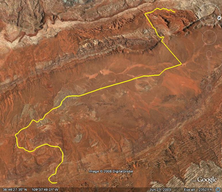
 Tower Arch (Moab, UT)
Tower Arch is a 4×4 trail located within the boundaries of Arches National Park. Taking this trail to see the Tower Arch is a great way to get away from the busier parts of the park during the Spring and Fall seasons. To reach this trail, you need to turn off the main park road at Salt Valley Road near Skyline Arch.
The beginning part of the trail and the end of the trail consists of some soft sandy sections. While the middle part of the trail is a bit rocky with some smaller ledges. Most 4×4 vehicles with decent ground clearance should not have any problems navigating this trail. Once you reach the end of the trail, there is an easy 0.3 mile hike to get to Tower Arch.
Unfortunately, the trail that heads to Balanced Rock from the Tower Arch trail was washed out and closed when I ran this trail. If that section ever opens again, you can take that trail over to see the Eye-of-the-Whale Arch as well.
Please feel free to leave your comments and post your pictures from Tower Arch below.
 Tower Arch KML Track
(Right click and ‘Save Target As’)
Open file above in Google Earth.
2 comments | posted in Trails
![]() Tincup Pass KML Track
Tincup Pass KML Track


