Apr
15
2008
 Poison Spider Mesa (Moab, UT)
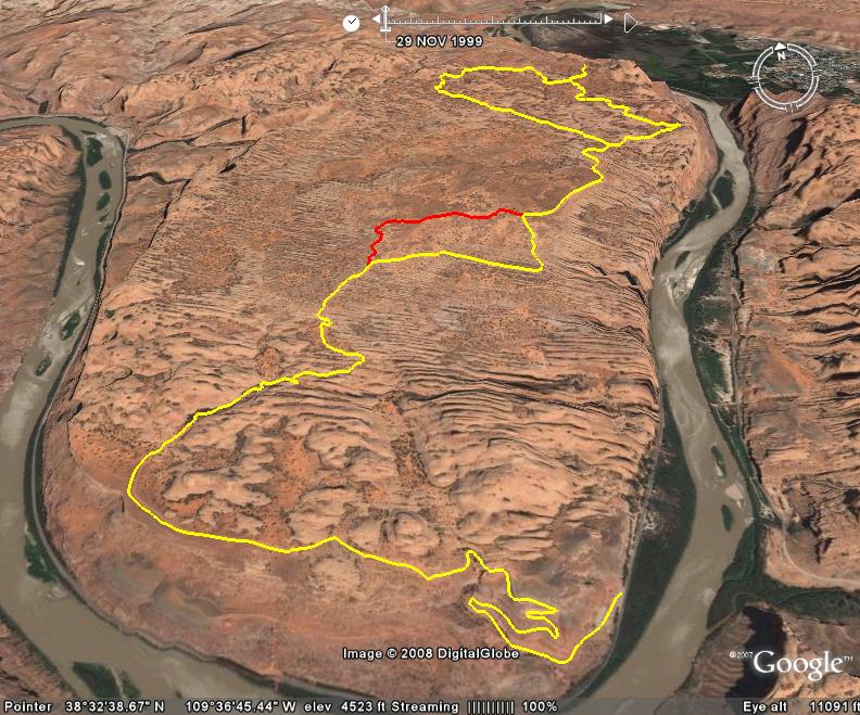
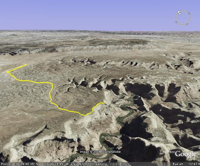
Poison Spider Mesa is one of Moab’s classic trails that offers a number of challenging obstacles and excellent scenery. It is also one of Moab’s more popular trails. This trail requires a high-clearance 4×4 vehicle as there are a number of obstacles. While some of them can be bypassed, others cannot be avoided.
This trail can get confusing in areas, and having a guide familiar with the trail or a GPS track would be highly recommended. There are a couple of overlooks that can also be explored off of the loop section of the trail. Also, don’t forget to stop and checkout Little Arch. It’s a very short hike, and well worth it. You can also look down on Moab Rim from this area, and get a great view of the Colorado River and the city of Moab.
Poison Spider Mesa is also the most commonly used entrance to the Golden Spike trail, which turns off right before the loop part of the trail begins. Then after Golden Spike, you can exit via Gold Bar Rim. This is a common route, but be prepared, as it can take all day to complete.
Please feel free to leave your comments and post your pictures from Poison Spider Mesa below.
 Poison Spider Mesa KML Track
(Right click and ‘Save Target As’)
Open file above in Google Earth.
Comments Off on Poison Spider Mesa | posted in Trails
Apr
10
2008
 Shafer Trail (Moab, UT)
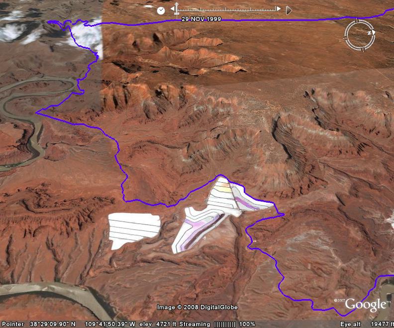
Shafer Trail is a nice relaxing drive for any stock high-clearance 4×4 vehicle. This trails offers specatular views overlooking the Colorado River, especially from Fossil Point, also known as the Thelma and Louise Point because the final scene of the movie was filmed there. The tight switchbacks within Canyonlands National Park are also another highlight of this trail.
The tight switchbacks on this route were originally constructed by Frank and John Shafer, two ranchers in the area in 1914 who used this route to drive their cattle down from the top of the Mesa. It was later widened in the 1950’s and used by trucks carrying Uranium ore to Moab.
I really enjoy driving this trail and taking in the great views. It also makes a nice loop when combined with Long Canyon. The White Rim trail is also accessed from this trail inside Canyonlands.
Please feel free to leave your comments and post your pictures from Shafer Trail below.
 Shafer Trail KML Track
(Right click and ‘Save Target As’)
Open file above in Google Earth.
Comments Off on Shafer Trail | posted in Trails
Apr
9
2008
 Old Monarch Pass (Pitkin, CO)
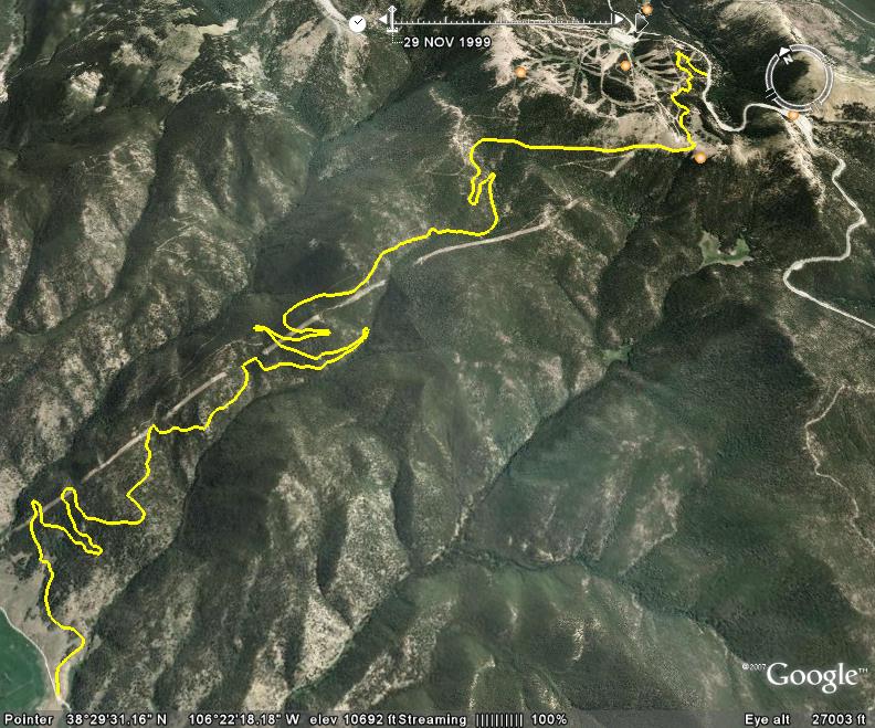
Old Monarch Pass is an easy scenic drive right off US 50, and an alternate route to staying on US 50 over Monarch Pass. In good weather, a passenger vehicle would have no problems following this trail.
This route was originally considered to be the pass that US 50 would go over, however a new pass was constructed that was shorter and contained less dangerous curves, even though the new route ended up costing more. This newly constructed pass was originally called Vail Pass, when Charles Vail named it after himself. But local residents complained and it was renamed to Monarch Pass. Now this route is referred to ‘Old’ Monarch Pass.
The best views on this trails are near the pass itself, which has an 11,375 foot elevation. This trail is not very long and is easily combined with any combination of the other local trails. Plus, it does not see as much traffic as some of the other trails in the area.
If you are using this route as an alternative to US 50, once you reach the end of Old Monarch Pass, you can take a left and follow Tomichi Pass road back to US 50, or you can jump on Black Sage Pass and explore some of the other trails in the area.
Please feel free to leave your comments and post your pictures from Old Monarch Pass below.
 Old Monarch Pass KML Track
(Right click and ‘Save Target As’)
Open file above in Google Earth.
Comments Off on Old Monarch Pass | posted in Trails
Apr
4
2008
 Eagle Canyon (San Rafael Swell)
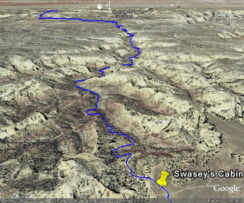
Eagle Canyon is easy to access right off of Interstate 70 in the San Rafael Swell. I would rate this trail moderate, as you will need a 4×4 with decent ground clearance to traverse it.
This trail offers great views from within Eagle Canyon and plenty of photo opportunities. You also cross under I-70 twice on this trail. The first time is through a culvert barely bigger than your Jeep. There is not much room for error. The second time is in the canyon where you pass under two large bridges. Check out the picture below.
After making it to the end of the canyon, you can continue on to Swasey’s Cabin with a large sandstone pillar behind it.
Please feel free to leave your comments and post your pictures from Eagle Canyon below.
 Eagle Canyon KML Track
(Right click and ‘Save Target As’)
Open file above in Google Earth.
Comments Off on Eagle Canyon | posted in Trails
Apr
3
2008
 Wedge Overlook (San Rafael Swell)
The Wedge Overlook is a short side-trip off of Buckhorn Draw, and well worth the trip. It’s an easy graded road that any passenger vehicle should be able to handle, and the view at the end of Utah’s “Little Grand Canyon” is outstanding.
This is a great area to stop and have lunch and there are also a number of good campsites if you are looking for a place to spend the night while exploring the Swell.
Please feel free to leave your comments and post your pictures from The Wedge Overlook below.
 Wedge Overlook KML Track
(Right click and ‘Save Target As’)
Open file above in Google Earth.
Comments Off on Wedge Overlook | posted in Trails
![]() Poison Spider Mesa KML Track
Poison Spider Mesa KML Track