Sep
27
2011
Saturday, September 24, 2011
After staying up late on Friday night, Amanda and I slept in on Saturday morning. When we finally woke up (between 8am-9am- which is sleeping in for us), we had some breakfast and then headed down to the North Rim of the Black Canyon of the Gunnison National Park. We have visited the South Rim a few times before, but for some reason had neglected to visit the North Rim. We arrived shortly after lunchtime and hiked to all the overlooks along the North Rim Road. The lighting was bad during this time of the day, so I didn’t even bother to carry my camera with me. After visiting all the overlooks near the road, we took our time as we hiked the short loop that visited Chasm View near the campground.
We ended up finishing the hiking we had planned to do earlier than I had planned, so we still had plenty of time before sunset. We decided to head back into Crawford for some dinner at the Black Canyon Cafe before returning to the park for sunset.
North Rim Road
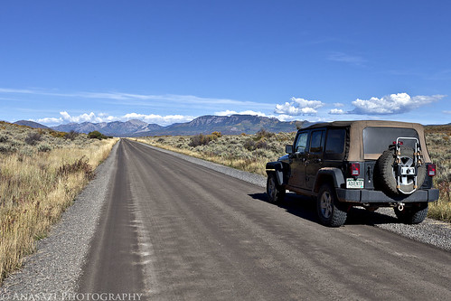
I took this photo as we left the park and headed back towards the West Elks and Crawford.
Needle Rock
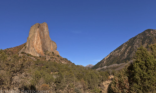
After dinner we took the short drive to visit Needle Rock since we had some extra time.
Black Canyon Sunset
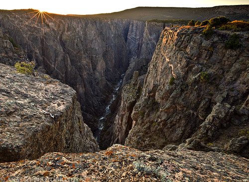
Catching the last rays of the sun over the Black Canyon.
Balanced Rock Overlook
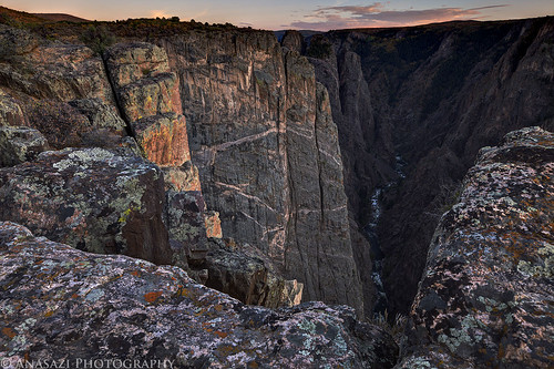
After the sun dipped below the horizon I turned around and took a few photos up-canyon.
Black Canyon Crack
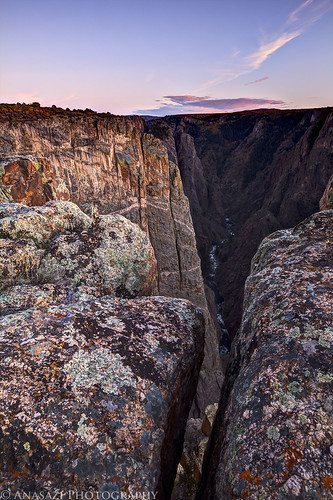
In order to get to the viewpoint I took the previous two photos from, I had to step over this crack in the rock next to the edge. It was a long way down. On my way back to the Jeep I decided to take a photo looking down through the crack.
3 comments | posted in Adventures, Hiking, National Parks & Monuments, Photography, Trip Reports
Sep
26
2011
Friday, September 23, 2011
After work on Friday, Amanda and I headed down to Moab to meet a few friends at the Moab Brewery for a birthday party and some burgers. After dinner we hiked up to the Moab Maiden in the dark so that I could attempt some night photography there again. Here’s a few of my photos from the night.
Under the Dipper

This is probably my favorite photo from Friday. I was able to frame the shot so that the Big Dipper was right over the large boulder containing the petroglyph.
Milky Way Princess
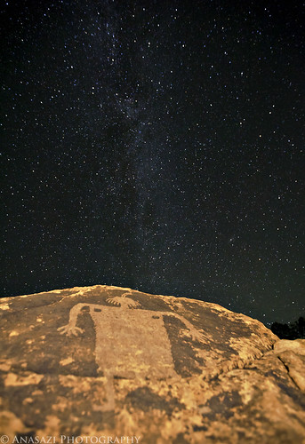
This one didn’t turn out as well as I had hoped, so I guess I will have to try again sometime in the future.
Maiden Star Trails
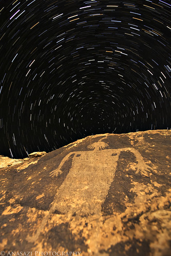
I have taken a photo of the Moab Maiden with star trails before, but I wanted to attempt the shot again. I think this one turned out better than the last, but I’m still not entirely happy with it. Either way, we had a nice evening examining the skies. We even spotted a few shooting stars.
2 comments | posted in Adventures, Hiking, Photography, Rock Art, Trip Reports
Sep
21
2011
September 17-18, 2011
This past weekend I met up with Jim from the Rock Art group on Flickr since he was spending a week or two in Moab. Of course we went out and visited some rock art sites that he had not been to before, and he even brought me to a few sites that I had missed before.
Wrong Way!
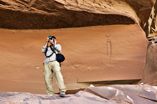
Jim takes a photo in the wrong direction as he stands next to the Lonesome Shaman.
Antler Men
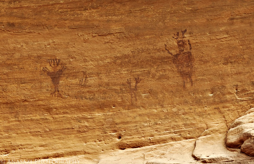
I’ve visited this faint pictograph panel with figures that appear to be wearing antlers before, but don’t think I have ever posted a photo…..so here you go…
Strange Creature
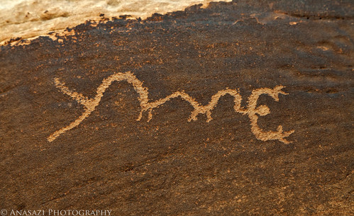
Somehow I managed to miss this petroglyph a few times in the past when I visited the Supplication Panel….probably because I never tried to actually get up near the panel.
Jim at the Supplication Panel
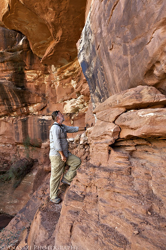
Jim admires the Supplication Panel up close.
Missing Detail
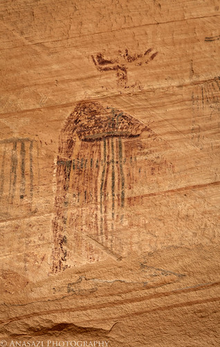
We made a stop at the Bartlett Panel pictographs. This figure was probably very impressive before it weathered away.
Moab Cutouts
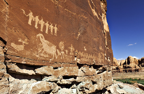
A line of small anthropomorphs high above the Colorado River.
Two Heads Are Better Than One
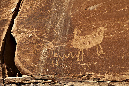
One sheep with two heads. There’s a few unique sheep petroglyphs in the area.
Moab Mastodon
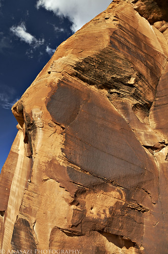
We also made a stop by the Moab Mastodon.
Fin Sunset
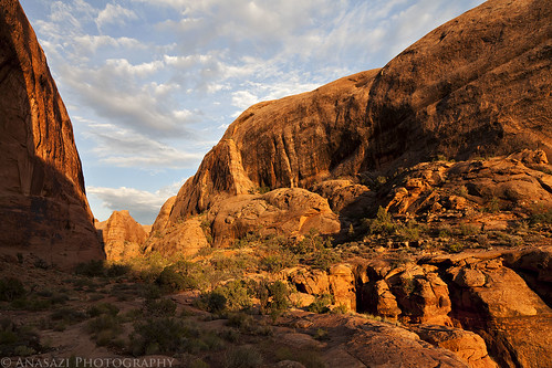
The sunlight from the setting sun reflects off of some fins in the Behind the Rocks wilderness.
Birdcage & Friends
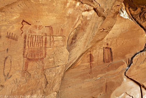
A large anthropomorph that resembles a birdcage (or R2D2) and a couple of other unique figures.
Birdcage Alcove
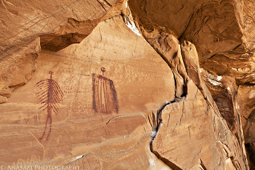
A closer look at two prominent figures of the Birdcage Panel situated in a large alcove.
Rock Art Shirt
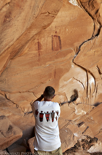
Jim showing off his rock art shirt while taking a photo of some pictographs.
Jim at the Birdcage
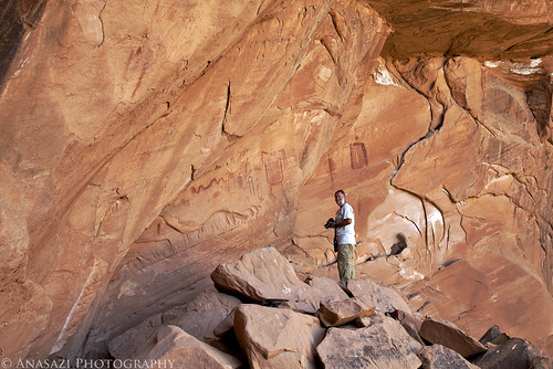
Jim and the Birdcage Panel for a little scale.
Anticline Overlook
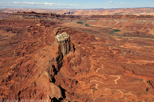
Expansive view from the Anticline Overlook looking down on Hurrah Pass and towards Moab and The Portal.
Highway 128
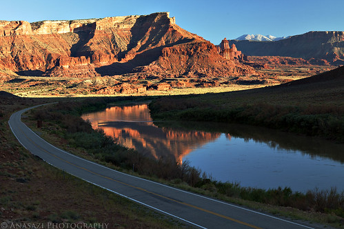
I decided to stop and take this photo on the way home….I seem to drive this stretch of road almost weekly so I rarely stop for photos anymore.
Jeep & Fisher Towers
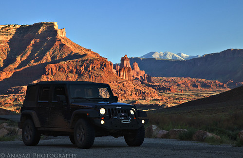
My Jeep, the Fisher Towers and La Sal Mountains.
Comments Off on Moab Area Rock Art XII | posted in Adventures, Barrier Canyon Style, Hiking, Photography, Rock Art, Trip Reports
Sep
16
2011
Saturday, August 27, 2011
When I chose my photo for the month of August earlier this week, I realized that I never posted a trip report from our day driving over Imogene Pass. Even though it really wasn’t much of a ‘trip’ I did take a couple of photos on our nice leisurely drive over Imogene Pass from Telluride to Ouray. We started out the day at Bridal Veil Falls for a few photos before driving over the pass. Afterwards we stopped in Ridgway for some burgers before heading back home. Here’s just a few photos from the day.
Bridal Veil Falls
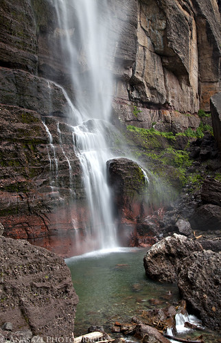
I’ve driven by these falls a number of times but never stopped and hiked up to them. That changed on this trip.
Bridal Veil Pool
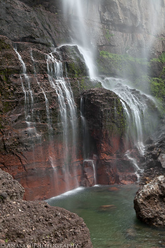
The main fall kept moving with the wind, so every second it seems the waterfall looked different. It was pretty cool to watch.
Distant Storm
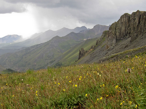
A storm off in the distance viewed from up in the Savage Basin.
Jeep at 13114
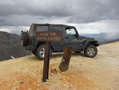
Imogene Pass….this might be the first time I have been up there with no snow or rain falling, even though it looked like it might start at any moment.
Top of the Pass
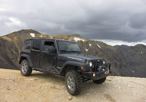
One more of my Jeep at the pass.
Richmond Falls
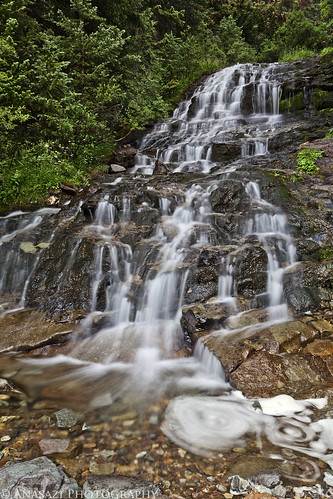
A great waterfall we visited on our way down to Telluride. The overcast sky made perfect conditions to get some longer exposures.
Comments Off on Imogene Pass | posted in Adventures, Photography, Trip Reports, Waterfalls
Sep
15
2011
September 10-11, 2011
The White Rim Trail seems to be the one I just can’t complete. I’ve been wanting to for years, but it just never seems to happen. The first big issue for me is getting a permit to camp along the trail (yes, I know I could probably get around the full trail in a day if I wanted, but I would prefer to enjoy it and not rush through it). I dislike planning my weekend trips too far in advance, so in the past I have always just never bothered to try to get a permit. Finally, last year I decided I really was going to try and get a permit so that I could drive the trail near the end of the year. Unfortunately, a storm managed to wash out the Mineral Bottom switchbacks making a complete loop impossible for a while. Once they repaired the switchbacks earlier this year I actually managed to reserve a permit for September. Who knew that the Green River would flood for much of the spring and summer and the road would again be closed? I was hoping Canyonlands would open the road right before our trip this last weekend, but thanks to anothe storm causing some damage to the switchbacks again on Friday, it just wasn’t in the cards this time. We decided to drive to our campsite at Murphy Hogback on Saturday and then drive back out the same way on Sunday. Even though we didn’t get to complete the full loop, we had a great time and am glad we still went. I guess there’s always next year to try again! On a side note, the park opened up the complete loop again on Tuesday…..we were just a few days too early….oh well!
Maybe you’ll be pleasantly surprised to find out that there is not going to be any rock art photos in this trip report! It was actually kind of nice to get back into taking photos of the landscape and my Jeep. Enjoy the photos!
Shafer Trail
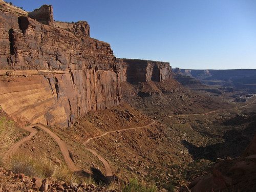
A few of the switchbacks on the Shafer Trail that take you down to the White Rim from the Island in the Sky.
Colorado River Overlook
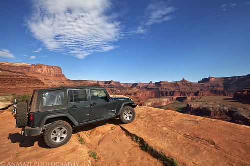
We stopped at the Colorado River Overlook across from the The Gooseneck.
White Rim Trail
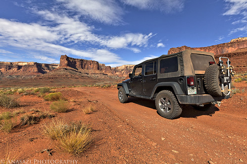
My Jeep on the White Rim Trail headed towards the Island in the Sky.
Descending Towards the Airport
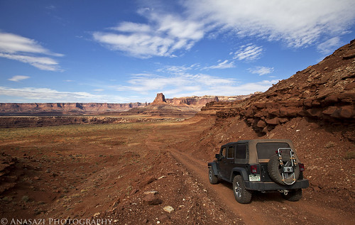
Following the road down towards Airport Tower.
Head of Lathrop
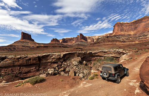
This road would be much shorter if it didn’t have to avoid many deep canyons along the route. Here it loops around the head of Lathrop Canyon.
Colorado River
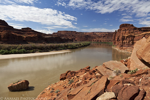
We took the side trip down Lathrop Canyon to the Colorado River. We saw no one on the river while we were there. I’d love to float this section of the river in the future!
Lathrop Canyon Intersection
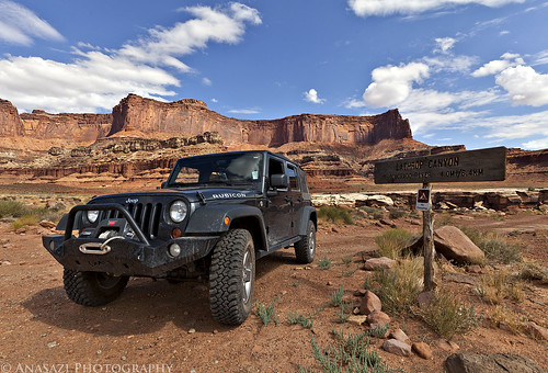
Back at the signed intersection for Lathrop Canyon and the White Rim.
On the Edge
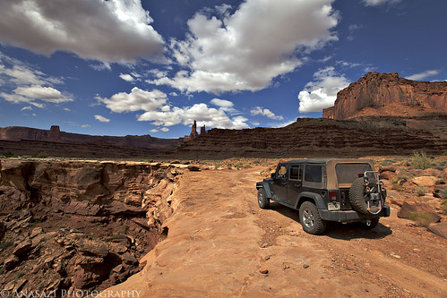
Skirting around another deep canyon cut into the White Rim. Washer Woman Arch and Monster Tower can be seen in the distance. We also spotted Mesa Arch from the trail (not visible in any photos I have posted) which looked tiny from below.
White Rim View
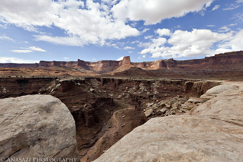
View down into a deep chasm with the Island in the Sky in the background.
Continue reading
2 comments | posted in Adventures, Camping, Hiking, National Parks & Monuments, Photography, Trip Reports


