May
1
2011
The Maze and the Mesa (April 2011)
Day 6: Moon House & Upper Johns Canyon
Thursday, April 14, 2011
After another very windy and cold night, Jared and I had some breakfast and headed over to the Kane Gulch Ranger station again. We wanted to make this an easy day since we had done a bunch of hiking all week, so we decided to go check out the Moon House Ruins. We had attempted this hike a few years ago (before the permit system was started) but we were unable to find the way down and across McLoyd Canyon to the ruins, so we wanted to finally reach the ruins this time. We arrived at the ranger station at 8:00am and quickly obtained our permit. Then we were soon on our way down the Snow Flat Road to the trailhead.
This time we did end up reaching Moon House Ruins and spent about 2.5 hours exploring the area. We were lucky and had the place all to ourselves. On our way back across the canyon to the Jeep we did eventually meet two other groups of three who were hiking in to the ruins. I guess we got there at a good time 🙂
Outer Wall
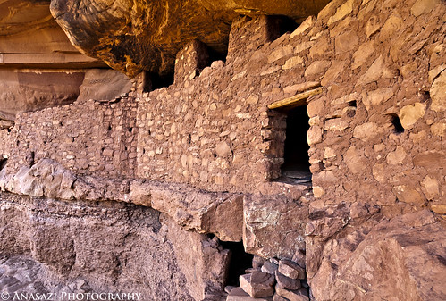
The outer wall of the main Moon House ruins.
Moon Snake
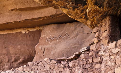
What looks like a snake pictograph located above the ruins.
Behind the Wall
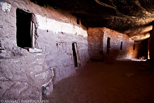
A view from behind the outer wall. A very cool and unique place.
Painted
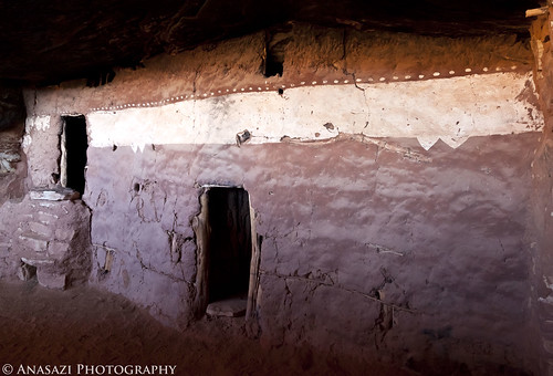
The very unique stripe painted on an interior wall that the Moon House Ruins is known for.
Stripe
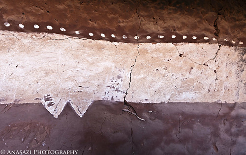
A closer look at the paint on the interior wall.
Spiked Snake
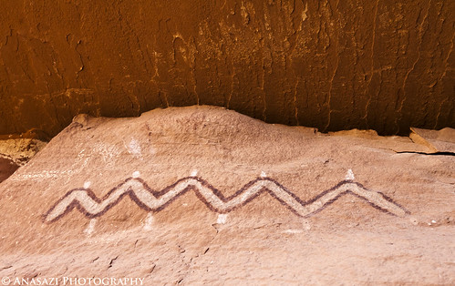
Here’s a closer look at the snake-like pictograph from inside the outer wall.
Three Rooms
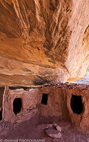
Three structures next to the main Moon House ruins.
Moon House Rooms
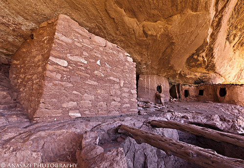
Many old structures make up the Moon House complex.
Striped Roof
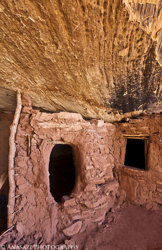
An interesting pattern and smoke-stained ceiling.
Round Room
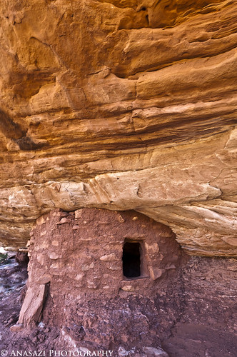
A small round structure found a little ways down canyon from the Moon House Ruins, but on the same ledge.
Continue reading
3 comments | posted in Adventures, Anasazi, Camping, Hiking, Photography, Rock Art, Trip Reports
Apr
26
2011
The Maze and the Mesa (April 2011)
Day 5: Sheiks Canyon & The Green Mask
Wednesday, April 13, 2011
We were up before sunrise on Wednesday for a quick breakfast so that we could get a quick hike down into Sheiks Canyon before Dave would have to head back home. First up in Sheiks Canyon was the Yellow House Ruin. The roof beams over part of this ruin still have the yucca lashings with knots tied to the roof beams. It’s a pretty amazing site.
Yellow House
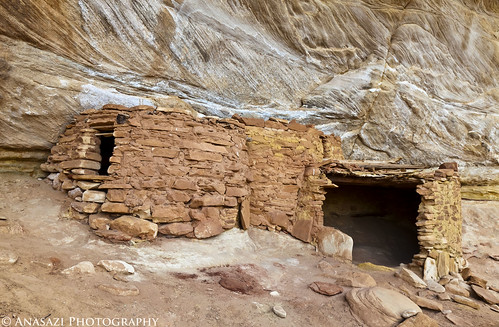
Yellow House Alcove
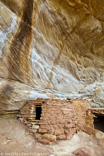
Yellow House Roof
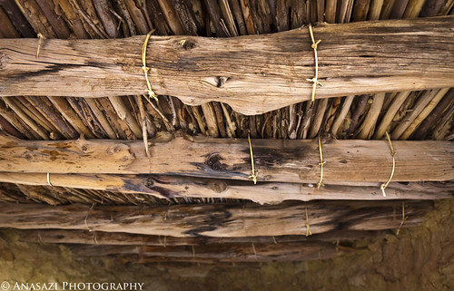
A good look at the very cool roof structure still intact.
Jared and the Yellow House
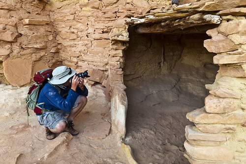
Jared takes a photo into the Yellow House.
A little further down the canyon we came across another small ruin.
Welcome Mat
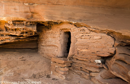
This small structure has a unique step right in front of the doorway.
Ruin & Faint Pictographs
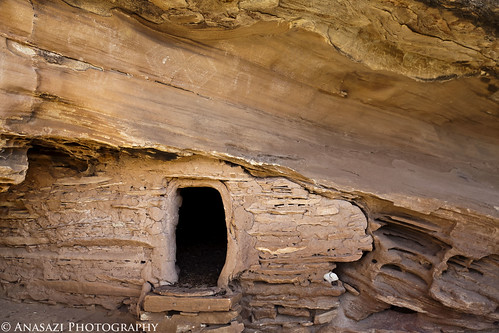
It also has some faint white pictographs located just above, than you can see in this photo.
As we continued down-canyon were a couple of steep talus slopes we needed to descend to get around some big pour-overs.
Sheiks Canyon
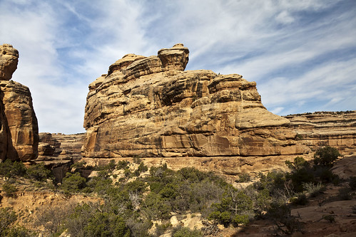
A view into Sheiks Canyon as we near Grand Gulch.
Dave and the Gulch
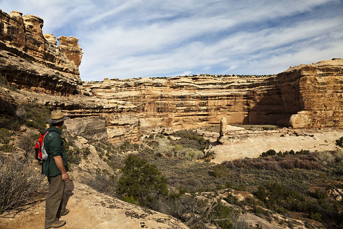
Dave looking down into Grand Gulch from a viewpoint along our hike.
Tucked-Away Granary
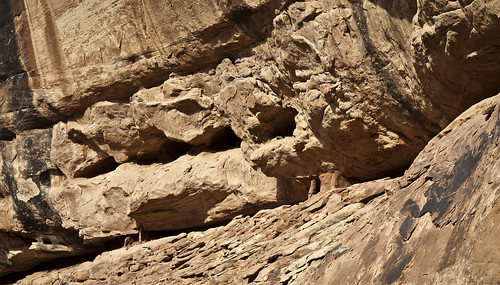
A small granary we passed by on our way to The Green Mask alcove.
Once we got near the confluence with Grand Gulch we spotted the Green Mask alcove with it’s ceiling filled with pictographs.
Ceiling Panels
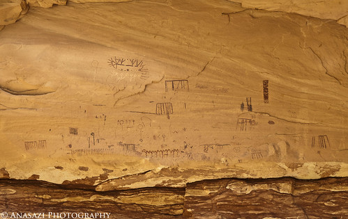
There were a lot of pictographs located near the ceiling of this alcove and out of reach. There are more in the photo below.
Continue reading
3 comments | posted in Adventures, Anasazi, Camping, Hiking, Photography, Rock Art, Trip Reports
Apr
24
2011
The Maze and the Mesa (April 2011)
Day 4: From the Maze to the Mesa
Tuesday, April 12, 2011
On our forth day Under the Ledge, we awoke to an awesome sunrise. The colors in the sky were just amazing! I quickly hopped out of my tent and grabed my camera for a photo. When I got my shot composed, I realized that I had taken the battery out the previous night to charge in the Jeep…and hadn’t replaced it! I ran back to the Jeep and grabbed the fully charged battery, but missed the best colors of the sunrise in the process. Here’s the shot I managed to get before all of the colors disappeared.
Color Over the La Sals
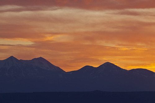
After the colors over the La Sal Mountains were gone, I turned around and took a few more early morning shots.
Standing Rock on Fire
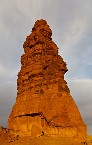
Standing Rock bathed in golden early morning sunlight on our last day in the Land of Standing Rocks.
Lizard and The Plug
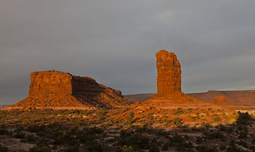
Lizard Rock and The Plug glowing in the early morning sunlight.
First Light
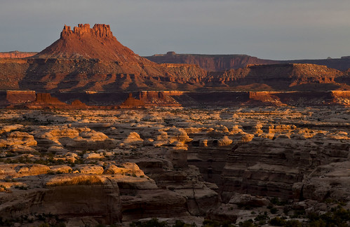
The first light of the day strikes Ekker Butte and the rims of the canyons that make up The Maze.
After sunrise we had some breakfast and packed up camp so that we could move on. We would have a long and full day ahead of us, since we would be leaving The Maze and heading to Cedar Mesa…but there would be plenty of stops along the way.
Before leaving The Maze we parked near Mother and Child Rock so that we could hike a little way into into Ernie’s country. We dropped down into Range Canyon so that we could visit Cedar Bark Ruin and Lou’s Spring.
Cedar Bark Ruin
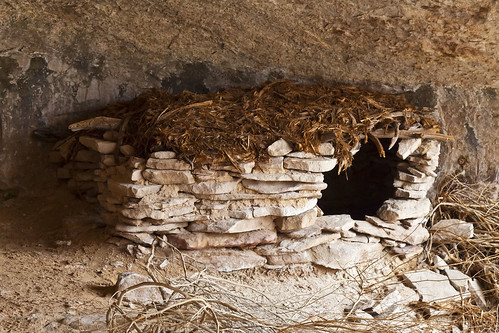
There has been some disagreement as to how old this ruin actually is, however, after seeing it in person, in my opinion, the ruin itself looks pretty old and not recently made, but the roof certainly looks newer, like someone may have added it. I’m no expert and these are just my impressions from my visit to the site.
Lous Spring Pictographs
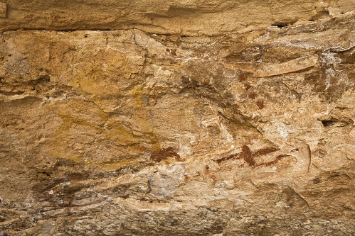
These very faint pictographs found on the ceiling of the alcove that contains Lou’s Spring kind of remind me of the one’s located across the Colorado River in Cave Spring in the Needles District.
After reaching the Jeeps again, we finally started to head out around Teapot Canyon. Along the rough road we met some of Canyonland’s rangers in 4×4 training. We had to wait for a few minutes to let them pass. They were driving the roughest stretch of road in the park’s 4-door Jeep Rubicon Wrangler.
Leaving the Maze
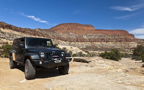
Just a photo of my Jeep as we head out of The Maze.
Continue reading
Comments Off on From the Maze to the Mesa | Day 4 | posted in Adventures, Anasazi, Barrier Canyon Style, Hiking, National Parks & Monuments, Photography, Rock Art, Trip Reports
Apr
22
2011
The Maze and the Mesa (April 2011)
Day 3: The Doll House & Tibbett Arch
Monday, April 11, 2011
During our second night camping at Chimney Rock there was much less wind, so I slept a lot better. When we woke up in the morning it was also a bit warmer and the wind had completely disappeared. I, of course, grabbed my camera and took a few photos as the sun was coming up.
Ekker Butte at Sunrise
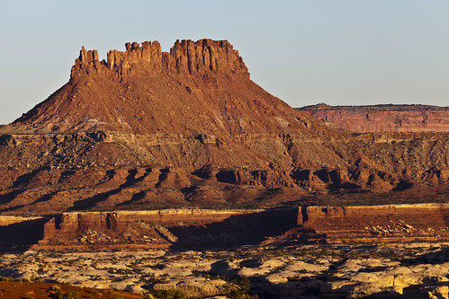
The sun rising in the east over the La Sal Mountains lights up Ekker Butte.
Layers in Blue
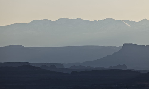
Early morning light looking towards the La Sal Mountains casts a blue hue over all the different layers of the landscape.
Chocolate Bars
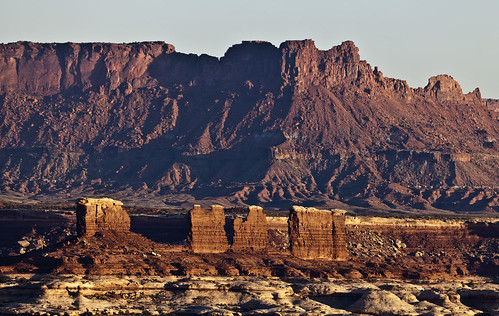
Known to most as The Chocolate Drops because they are misnamed on current maps. They really look more like Chocolate Bars to me, anyway. The Maze Overlook is located right behind them from this angle.
Chimney Rock Camp
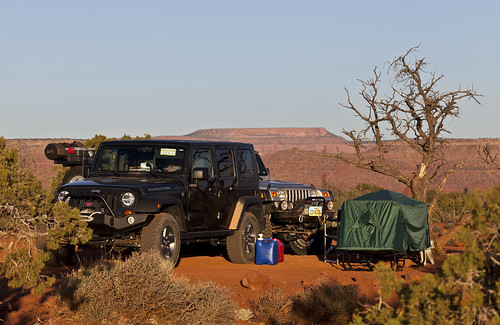
Our campsite near Chimney Rock before packing up and leaving.
Since our permit for the Chimney Rock camp was only for two nights, we packed up camp after some breakfast so that we could move on, and then headed to The Doll House.
Our first hike in The Doll House area was the Granary Loop, which gave us a nice view of Surprise Valley on our way to visit a few hidden ruins.
The Doll House

View of The Doll House while hiking The Granary Trail.
Photos in the Slot
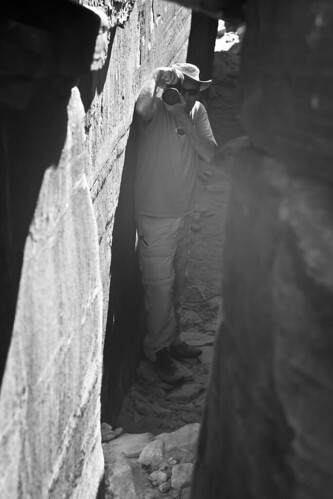
On our way to the granaries, we passed through this small slot. Jared takes my photo as I take his.
Checking Out Suprise Valley
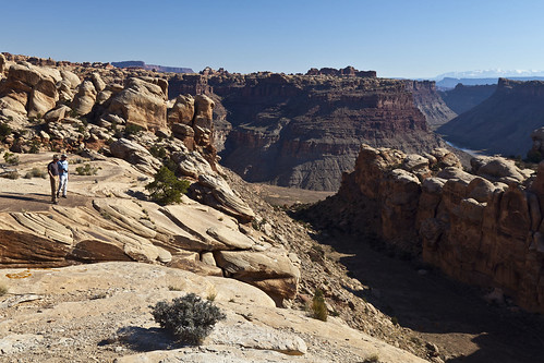
Dave and Jared check out Surprise Valley from above. Look closely and you can see the Colorado River.
Three Granaries
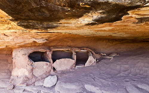
Three of the four small granaries lined up on one side of the alcove.
Continue reading
3 comments | posted in Adventures, Anasazi, Camping, Hiking, National Parks & Monuments, Photography, Trip Reports
Apr
20
2011
The Maze and the Mesa (April 2011)
Day 2: Pictograph Fork & The Harvest Scene
Sunday, April 10, 2011
Our second day started out cold with plenty of wind. None of us slept very well since the wind was noisy all night. After some breakfast we bundled up and started our hike down Pictograph Fork to check out the Harvest Scene pictographs.
Hiking Pictograph Fork
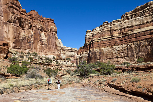
If you look closely you can see Dave and Jared in the canyon ahead of me as we hike towards Pictograph Fork.
Along the way we stopped at a petroglyph panel.
Pictograph Fork Petroglyphs
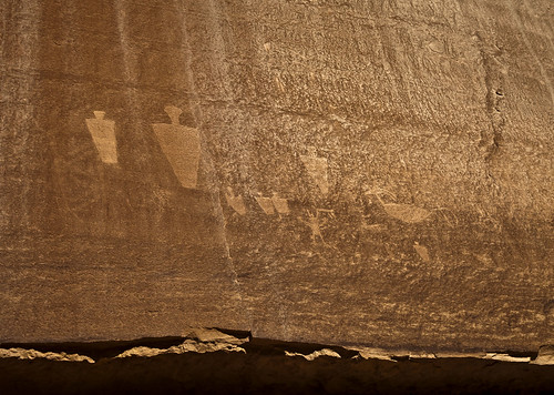
Pictograph Fork Anthropomorphs
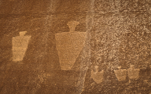
Then we continued on until we reached the Harvest Scene, which was one of my main reasons for going to The Maze this trip.
Near the Harvest Scene
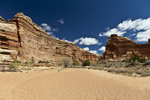
The canyon near The Harvest Scene Panel.
The sun was shining on the panel and washing it out pretty good, but luckily there were a few puffy clouds in the sky that blocked the sun for a few minutes at a time so that I could try and take some decent photos of the panel.
Harvest Scene Panel
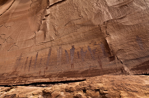
An overview of the Harvest Scene Pictograph Panel.
The Harvest Scene
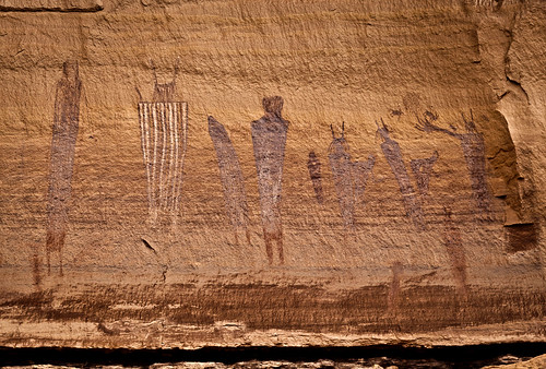
A closer look at the part of the panel that gives it the name ‘Harvest Scene’.
Tall, Skinny, & Elaborate
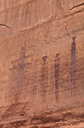
These figures found on the left side of the panel are very elaborately decorated.
Continue reading
Comments Off on Pictograph Fork & The Harvest Scene | Day 2 | posted in Adventures, Barrier Canyon Style, Camping, Hiking, National Parks & Monuments, Photography, Rock Art, Trip Reports


